Geuest

Countries & Culture / A field guide

Borders
& Beyond.

The lines are on the map.
The stories are in people’s lives.

Step into enclaves, cross divided towns, and discover places where a border is anything but ordinary.

Choose your journey

Four trails through fifty stories

Each trail selects five connected stories in the atlas and collection below. These are reading trails, not travel itineraries.

01 / Follow the line

An atlas of unexpected places

Choose a pin or a story below. Zoom in to separate nearby locations.

Loading the border atlas…
Enclaves · Europe

Baarle

One street. Two countries. Watch your doorstep.

Belgian and Dutch municipalities govern neighbouring pieces of the same built-up village. The border is marked on the ground rather than hidden in an atlas.

Educational geography, not travel advice. Historical arrangements are labelled; a photograph does not establish permission to cross a border.

02 / Beyond the novelty

Small lines. Extraordinary stories.

50 stories shown. Open a field note for the human story, timeline and sources.

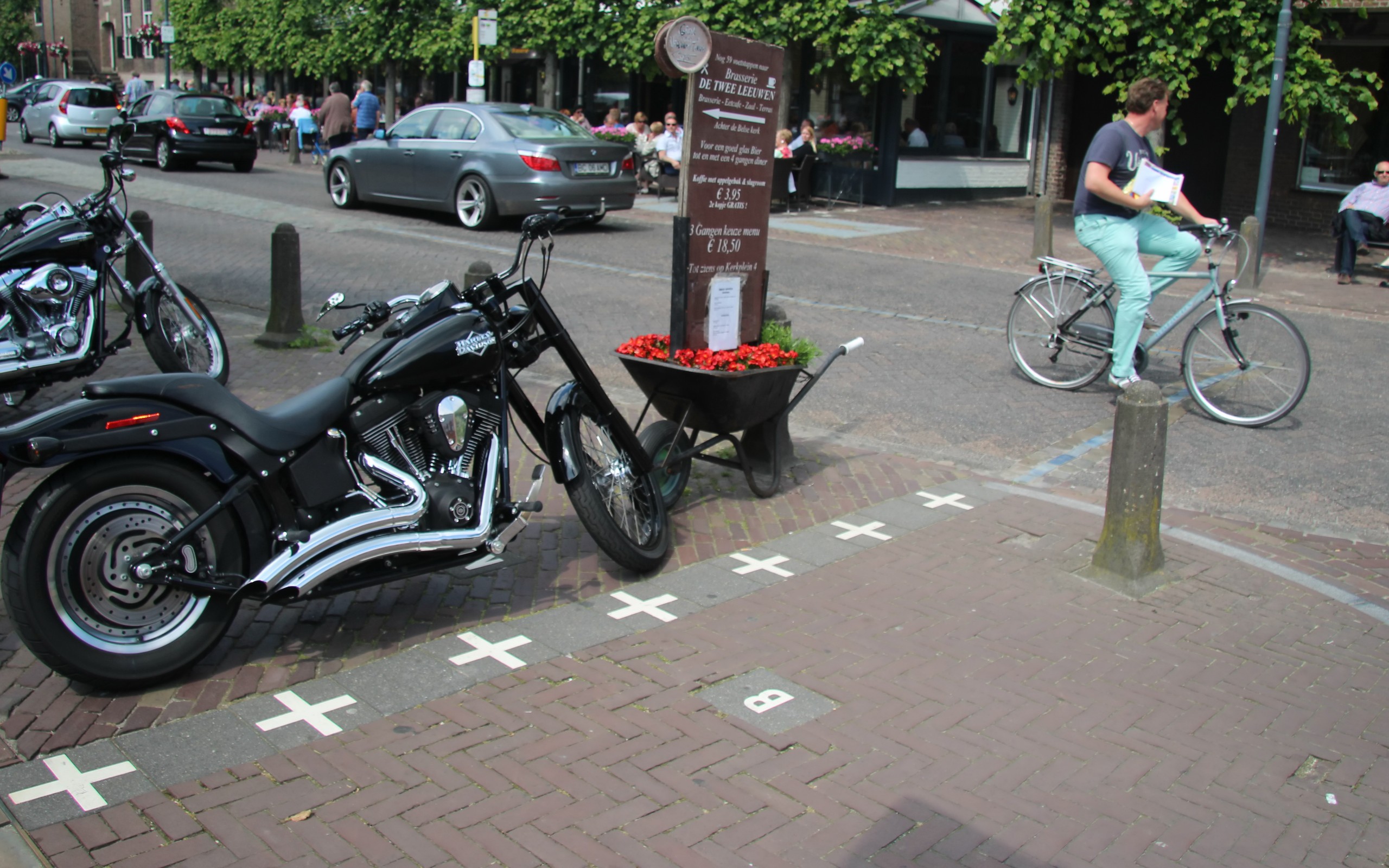
White crosses in a Baarle pavement mark the Belgian–Dutch border.
bertknot · CC BY-SA 2.0Cropped to 16:10; this adaptation is shared under CC BY-SA 2.0.
Enclaves · Europe

Baarle

One street. Two countries. Watch your doorstep.

In Baarle-Hertog and Baarle-Nassau, white crosses mark an international border that threads through streets, gardens and buildings. Belgian enclaves sit inside the Netherlands, with Dutch counter-enclaves inside some of them.

Open field notes
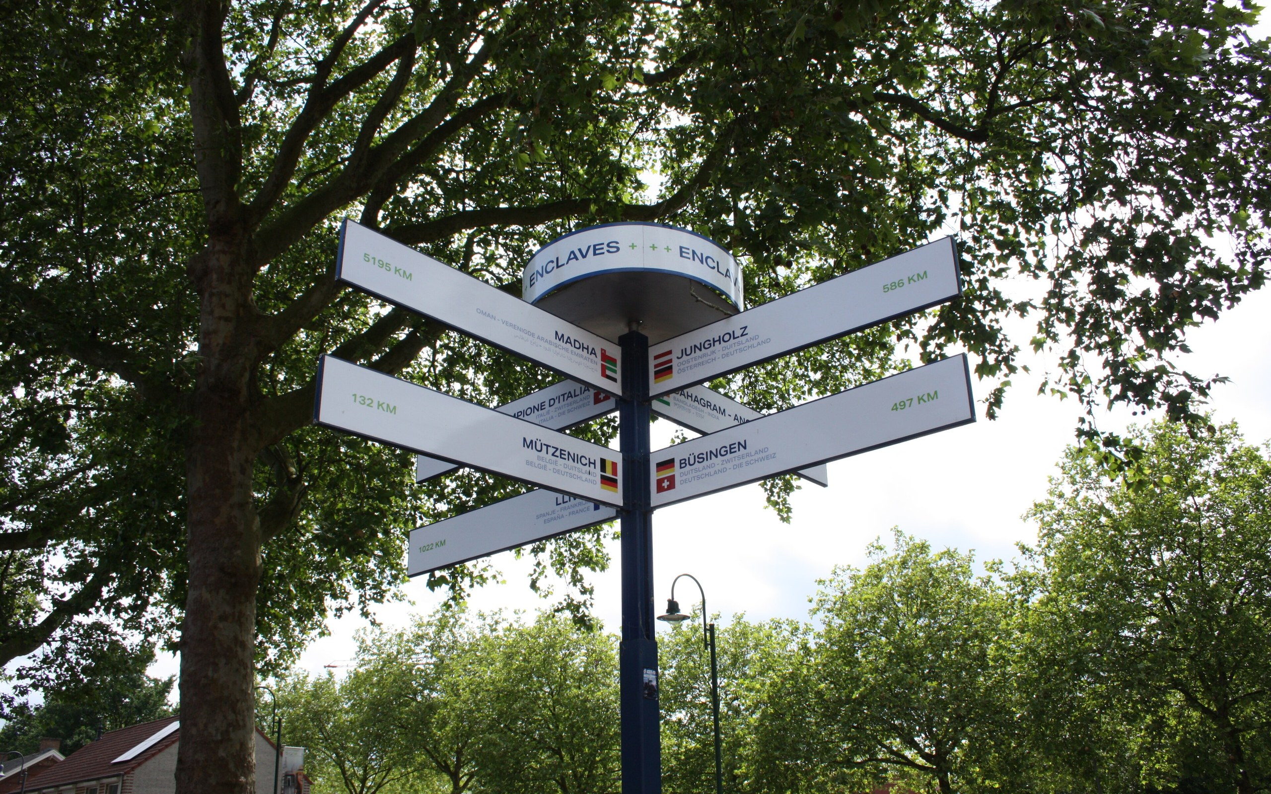
A multi-armed signpost in Baarle points the way to other enclaves.
Sneeuwvlakte via Wikimedia Commons · CC BY-SA 4.0Cropped to 16:10. This adaptation is shared under CC BY-SA 4.0.

Life across the line

For a building crossed by the border, the location of its main entrance generally determines its administrative address. That is a rule about residence and jurisdiction—not an automatic change of a person’s citizenship.

  1. Medieval origins

    Land ownership laid the foundations of the enclave pattern.

  2. 1995

    Further boundary measurements clarified the line; a famous front-door swap preserved a Belgian address.

  3. Today

    Border markers and national house-number plates make the patchwork visible.

A border can pass through a building without dividing the community into two distant places.

Compare Belgium & Netherlands ↗
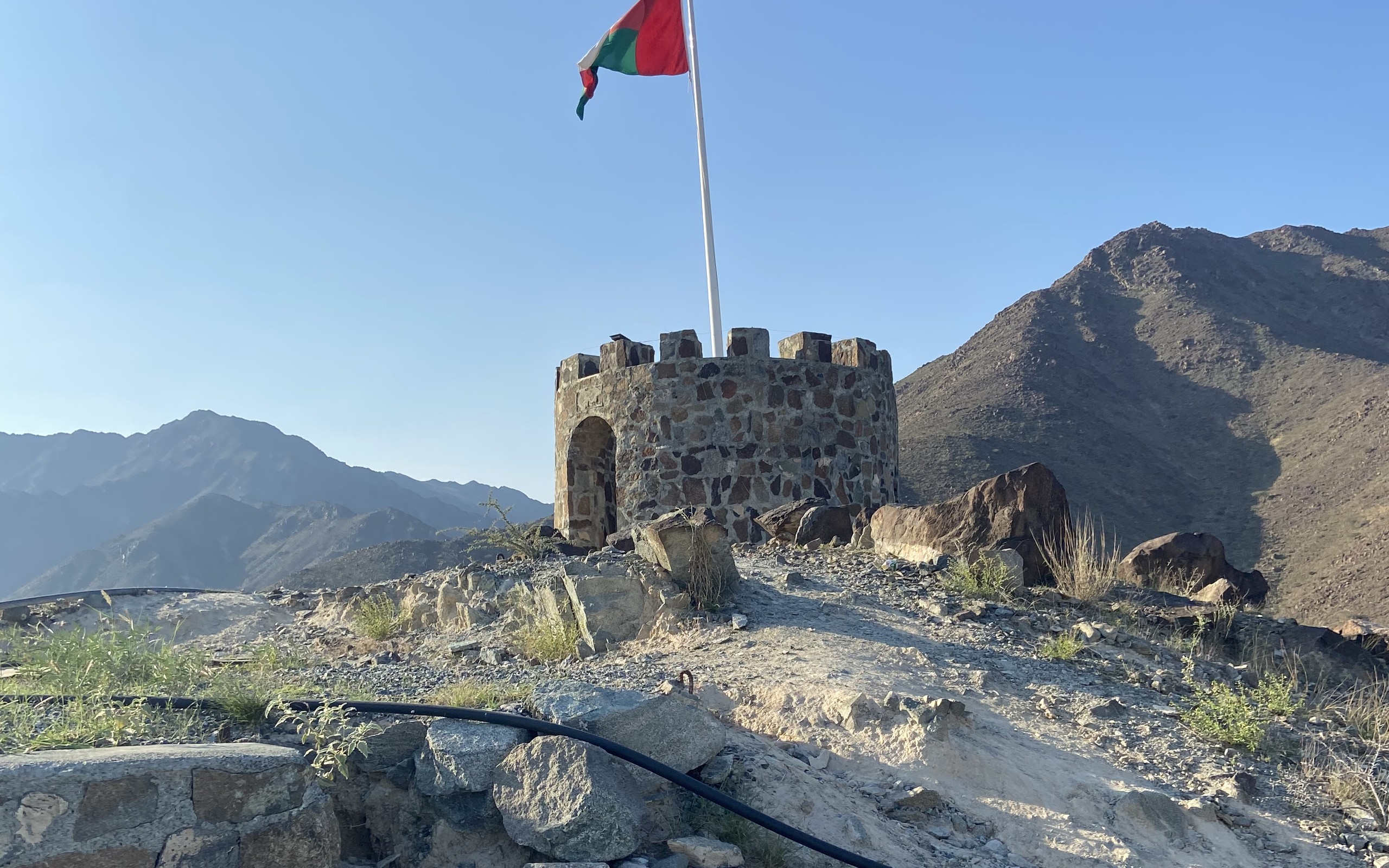
An Omani flag flies beside a hilltop watchtower in Madha, Oman.
frank saptel · CC BY 2.0Cropped to 16:10. Photograph shows Madha, not Nahwa.
Enclaves · Asia

Madha & Nahwa

A country inside a country… inside a country.

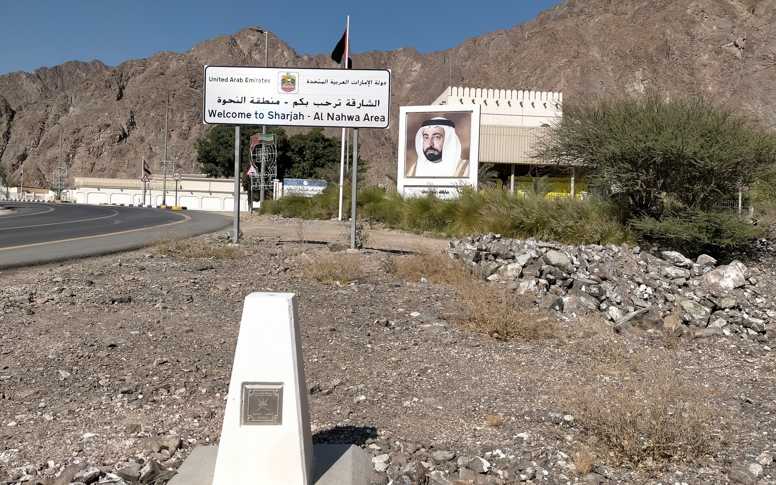
Madha is an Omani enclave surrounded by the United Arab Emirates. Within Madha lies Nahwa, which belongs to the emirate of Sharjah in the UAE. This is a real counter-enclave, not a cartographer’s mistake.

Open field notes
A white boundary pillar in front of a 'Welcome to Sharjah – Al Nahwa Area' sign in the mountains of the Nahwa enclave.
IbrahimKumar via Wikimedia Commons · CC BY-SA 4.0Cropped to 16:10. This adaptation is shared under CC BY-SA 4.0.

Life across the line

The unusual outline reflects communities and their affiliations, not empty pieces of a puzzle. Madha and Nahwa retain their different national administrations within the same mountain landscape.

  1. Local allegiances

    Madha aligned with Oman; Nahwa remained associated with Sharjah.

  2. Modern boundaries

    Those different affiliations became an enclave and a counter-enclave.

  3. Today

    Nahwa is administered by Sharjah, surrounded by Omani Madha.

A counter-enclave is an enclave inside another enclave.

Compare Oman & United Arab Emirates ↗
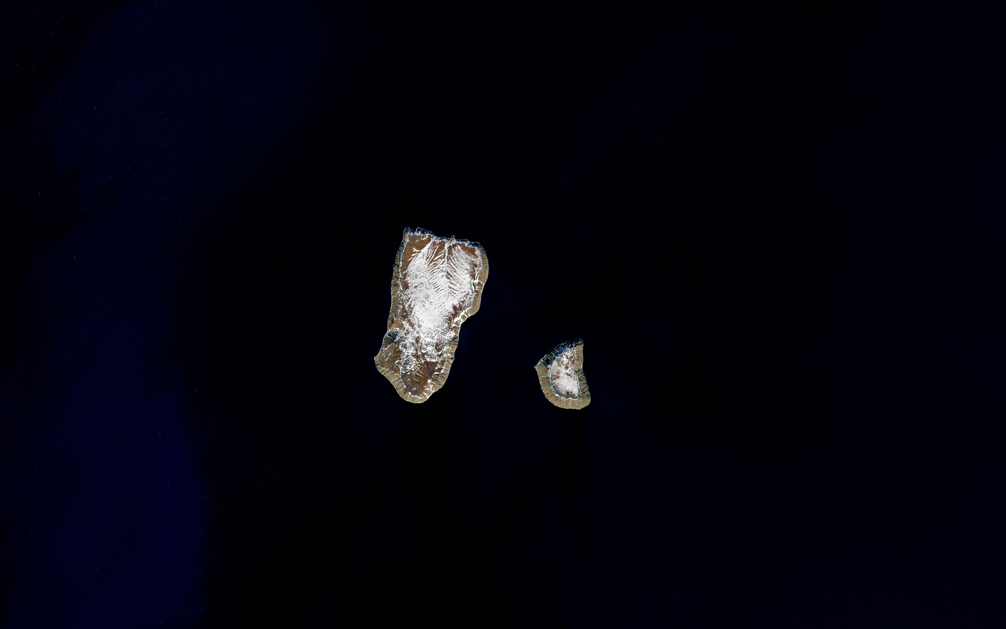
Landsat satellite photograph of Big and Little Diomede in the Bering Strait.
NASA Earth Observatory / Landsat 8 OLI · Public domainSatellite photograph, June 2017; cropped to 16:10.
Water & time · North America & Asia

The Diomede Islands

Look across the water—and across the date line.

Big Diomede belongs to Russia; Little Diomede belongs to the United States. The international boundary and International Date Line pass between these neighbouring islands in the Bering Strait.

Open field notes

Life across the line

Little Diomede is an inhabited Iñupiat community. Weather, sea conditions and the international border shape access; proximity does not mean people may freely walk or sail between the islands.

  1. 1867

    The Alaska purchase establishes the US–Russian boundary between the islands.

  2. Cold War

    A political divide separates communities across the Bering Strait.

  3. Today

    The islands remain under different national jurisdictions and timekeeping systems.

A date line is a timekeeping convention; an international boundary is a jurisdictional division. Here they run together.

Compare United States & Russia ↗
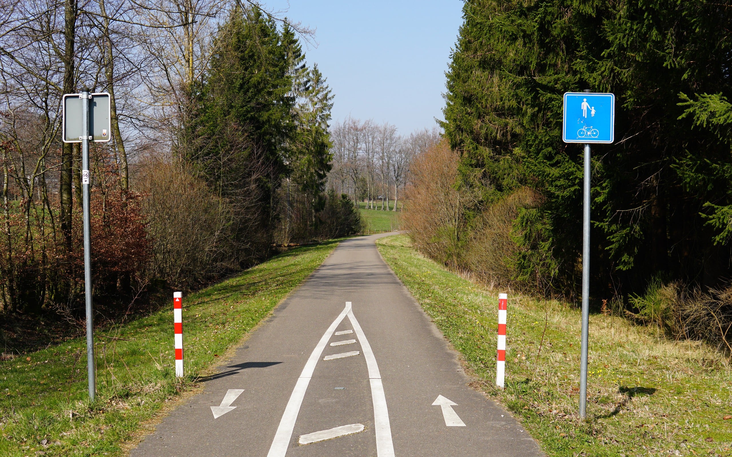
The Vennbahn cycle path near Monschau on the former railway route.
Lewin Bormann · CC BY-SA 2.0Cropped to 16:10; this adaptation is shared under CC BY-SA 2.0.
Enclaves · Europe

The Vennbahn

The railway that left pieces of Germany on the other side.

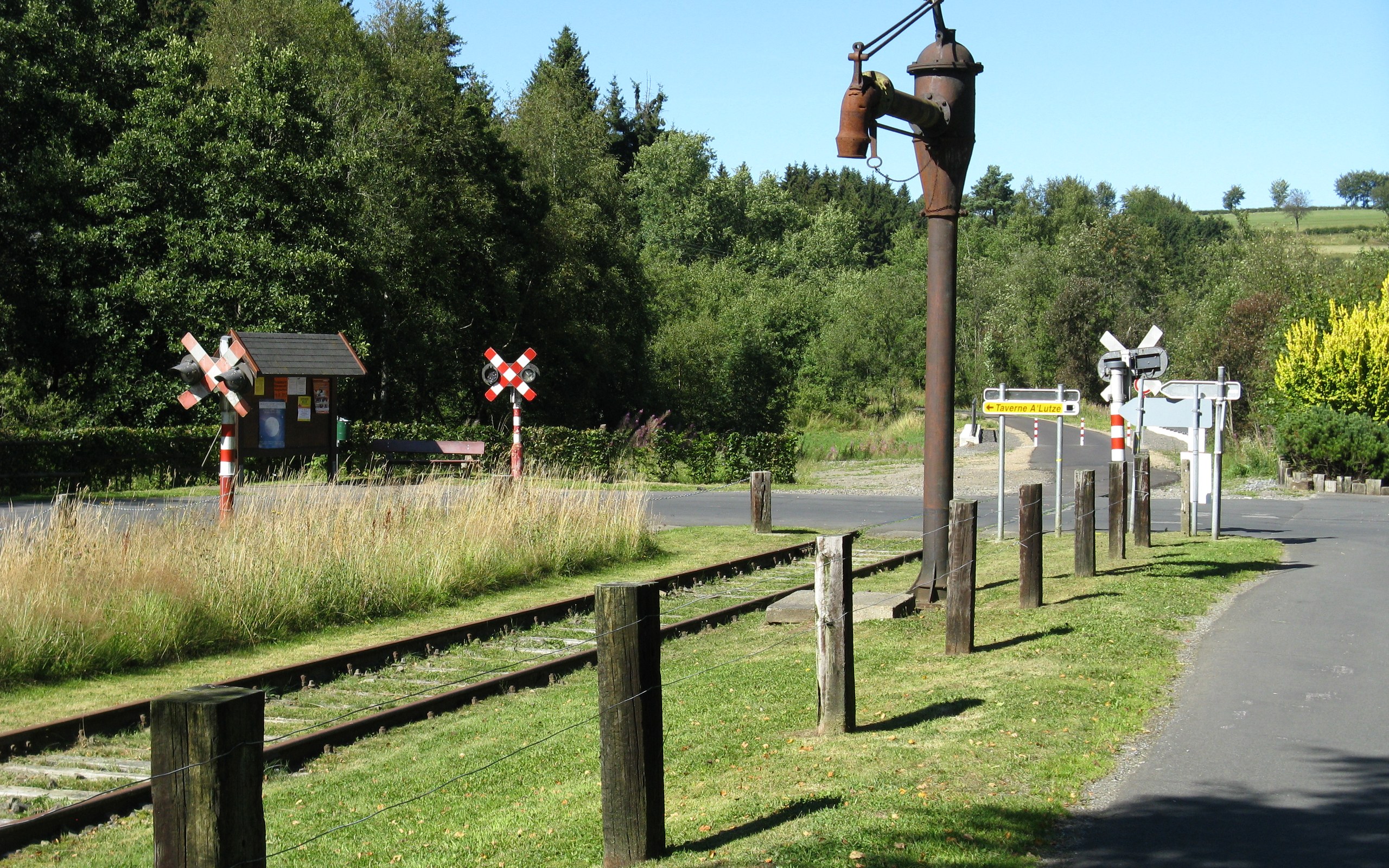
Parts of the former Vennbahn railway corridor belong to Belgium even where the route runs between German lands. The narrow strip separates German exclaves from the rest of Germany.

Open field notes
The end of the old Vennbahn railway tracks beside the cycle path at Kalterherberg station.
Andreas Toerl via Wikimedia Commons · CC BY-SA 3.0Cropped to 16:10. This adaptation is shared under CC BY-SA 3.0.

Life across the line

A map that treats every path as merely a road would miss the story. Here, cyclists travel along an old railway whose territorial status still explains neighbouring communities’ unusual geography.

  1. Railway era

    The Vennbahn connects industrial areas across the region.

  2. After World War I

    The corridor is assigned to Belgium, creating German exclaves.

  3. Today

    The former railway hosts an international cycle route.

A very narrow strip can separate territory even when the surrounding landscape looks continuous.

Compare Germany & Belgium ↗
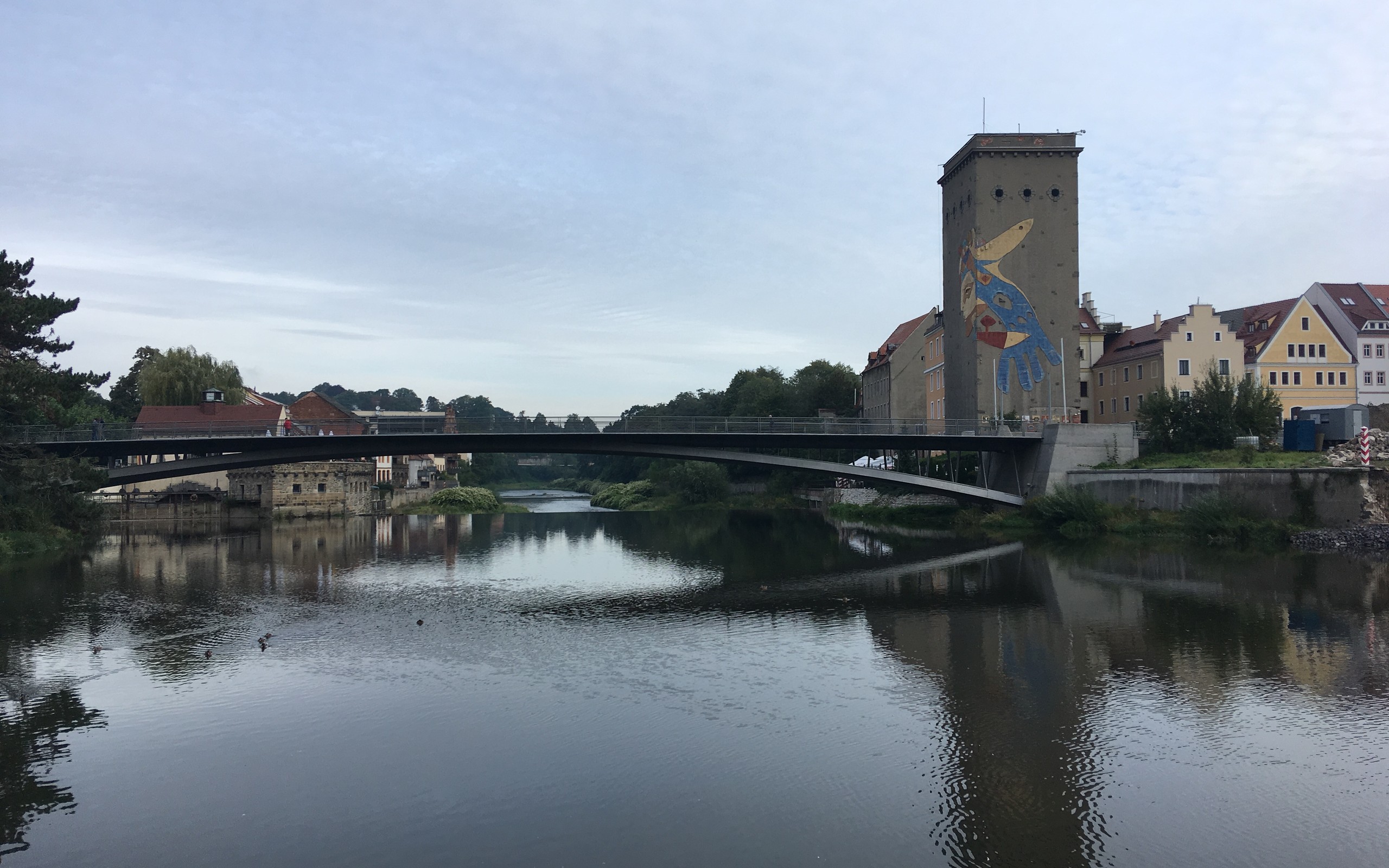
A pedestrian bridge over the Neisse between Görlitz and Zgorzelec.
Sergei Gussev · CC BY 2.0Cropped to 16:10.
Shared communities · Europe

Görlitz & Zgorzelec

Two names. Two countries. A bridge between them.

The Lusatian Neisse separates German Görlitz from Polish Zgorzelec. The towns grew from one urban settlement and now tell a story of division followed by cross-border cooperation.

Open field notes

Life across the line

Bridges and cultural cooperation connect residents across the river. The paired German and Polish names remind visitors that a shared cityscape can hold different languages, memories and national histories.

  1. 1945

    The city is divided along the Neisse.

  2. 1991

    A partnership agreement supports renewed cooperation.

  3. 1998

    Görlitz and Zgorzelec proclaim their European City partnership.

A border can remain in place while relationships across it change profoundly.

Compare Germany & Poland ↗
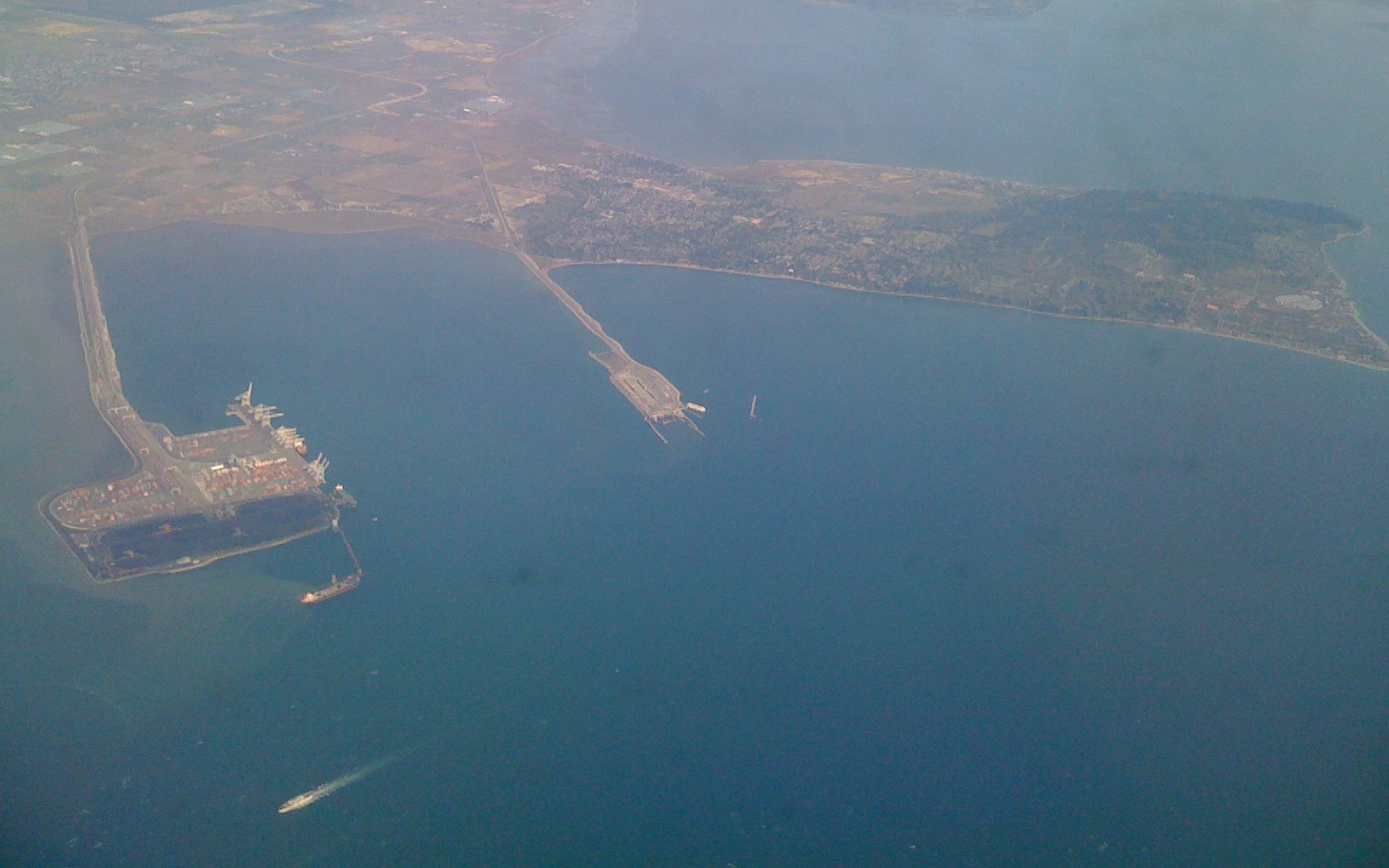
Aerial view of the Tsawwassen Peninsula and Point Roberts on the Canada–US boundary.
Scazon · CC BY 2.0Cropped to 16:10; photographed through an aircraft window.
Disconnected territory · North America

Point Roberts

To drive to the rest of your country, leave it first.

Point Roberts is American territory at the southern tip of the Tsawwassen Peninsula. Its land connection runs north into Canada, rather than directly into the rest of Washington State.

Open field notes

Life across the line

For residents, the line affects ordinary journeys and access to services. A short distance on the map does not necessarily mean a simple domestic drive.

  1. Before the treaty

    Indigenous communities use the peninsula and its coastal resources.

  2. 1846

    The Oregon Treaty places the boundary on the 49th parallel.

  3. Today

    Point Roberts remains part of Washington State, with road access through Canada.

A pene-exclave is attached geographically but more readily reached over land through another country.

Compare United States & Canada ↗
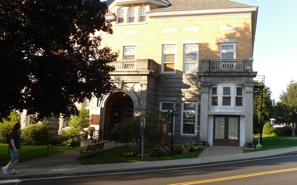
Exterior of the Haskell Free Library and Opera House on the Canada–US border.
Doug Kerr · CC BY-SA 2.0Cropped to 16:10; this adaptation is shared under CC BY-SA 2.0.
Shared communities · North America

The Haskell Library

A library where the border runs across the floor.

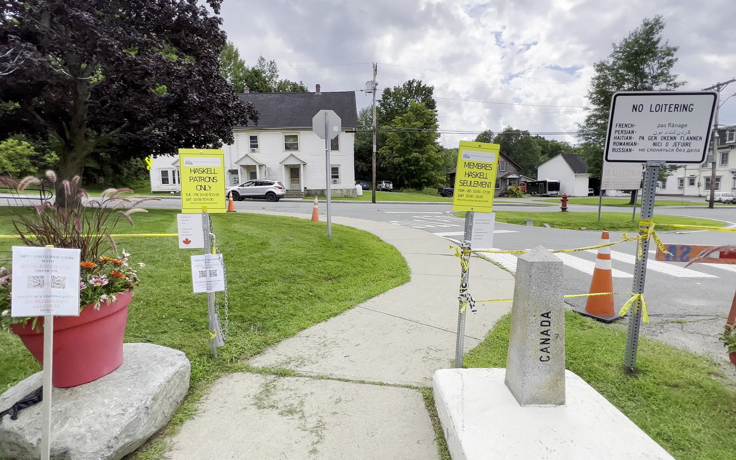
The Haskell Free Library and Opera House was deliberately built across the border between Stanstead, Quebec, and Derby Line, Vermont. Culture—not a checkpoint—was the purpose of this shared building.

Open field notes
A granite boundary marker inscribed 'Canada' beside a path outside the Haskell Free Library, with border-area signs behind.
Lea-Kim via Wikimedia Commons · CC BY-SA 2.0Cropped to 16:10. This adaptation is shared under CC BY-SA 2.0.

Life across the line

Books and performances connect neighbours whose addresses lie in different countries. Access arrangements can change; the library’s own visitor guidance matters more than an old travel anecdote.

  1. 1901

    Construction begins on the border-straddling building.

  2. 1904

    The opera house opens, serving the neighbouring communities.

  3. Today

    The institution continues its cultural role under regulated access arrangements.

A shared cultural building does not cancel immigration rules.

Compare Canada & United States ↗
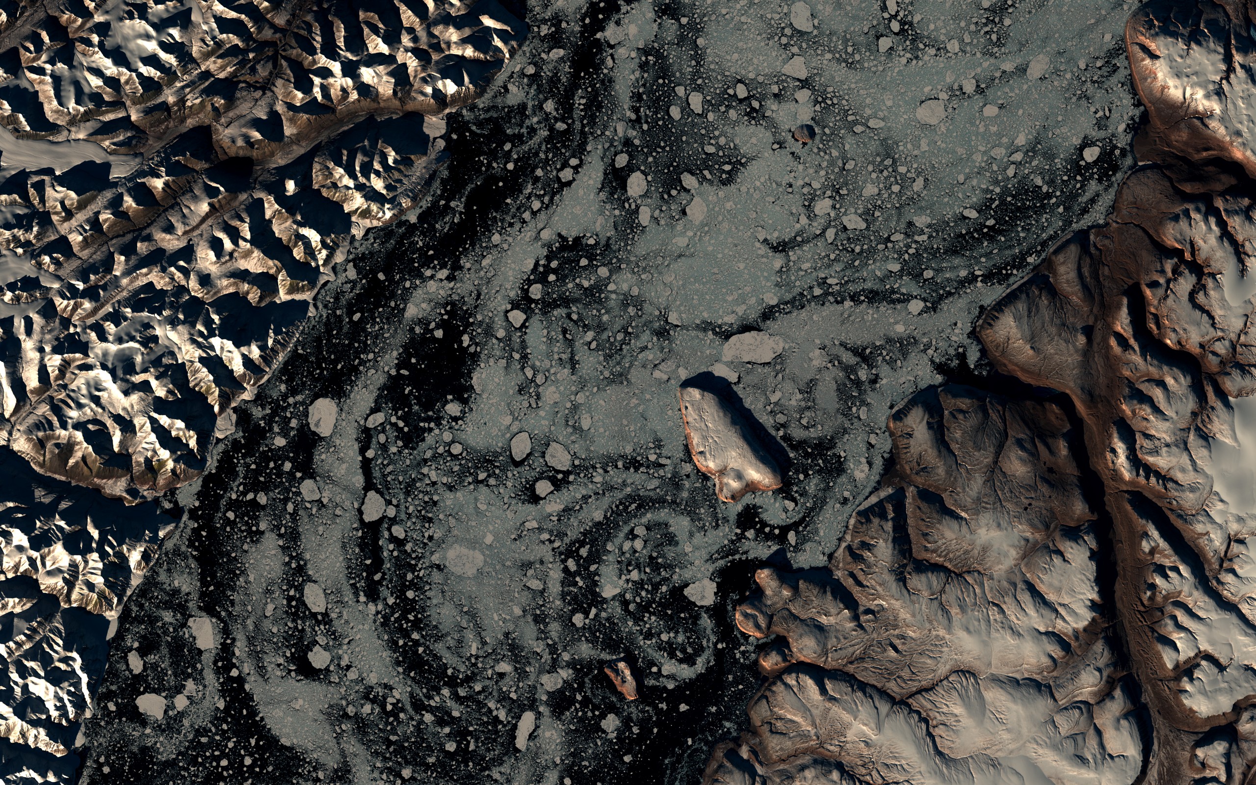
Landsat image of Kennedy Channel with Hans Island near the upper centre.
Landsat365 / USGS–NASA Landsat 8 · CC BYRegional satellite view; Hans Island is small near the upper centre. No boundary line is drawn.
Diplomacy · Arctic

Tartupaluk / Hans Island

A tiny Arctic island. A lesson in negotiation.

In June 2022, Canada and the Kingdom of Denmark, together with Greenland, signed an agreement to resolve the long-running dispute over Tartupaluk, also called Hans Island.

Open field notes

Life across the line

The agreement recognises the importance of continued Inuit access for traditional activities. The Indigenous name Tartupaluk helps place people and their relationship with the land ahead of the novelty headline.

  1. Long-running dispute

    Canada and Denmark maintain competing claims to the island.

  2. 14 June 2022

    Canada, Denmark and Greenland sign the boundary agreement.

  3. The agreement

    A ravine-based land boundary and provisions for Inuit access form part of the settlement.

Borders can be addressed through negotiation, while recognising communities whose connections predate them.

Compare Canada & Greenland ↗
Diplomacy / AsiaWhen changing a map helped change everyday life.

India · Bangladesh

Text field note · no photograph
Diplomacy · Asia

India–Bangladesh: the enclave exchange

When changing a map helped change everyday life.

For decades, pockets of Indian and Bangladeshi territory were surrounded by the other country. In 2015, an enclave exchange replaced much of that extraordinary patchwork with clearer jurisdiction.

Open field notes

Life across the line

Residents were offered choices concerning nationality and relocation. The story is as much about access to education, healthcare and legal identity as it is about the shape of territory.

  1. 1974

    The Land Boundary Agreement sets out a framework for resolving boundary questions.

  2. 2011

    A protocol addresses outstanding issues.

  3. 31 July 2015

    The agreed enclave exchange takes effect at midnight.

An old atlas can turn a resolved border problem into a misleading present-day “fun fact”. Always check the date.

Compare India & Bangladesh ↗
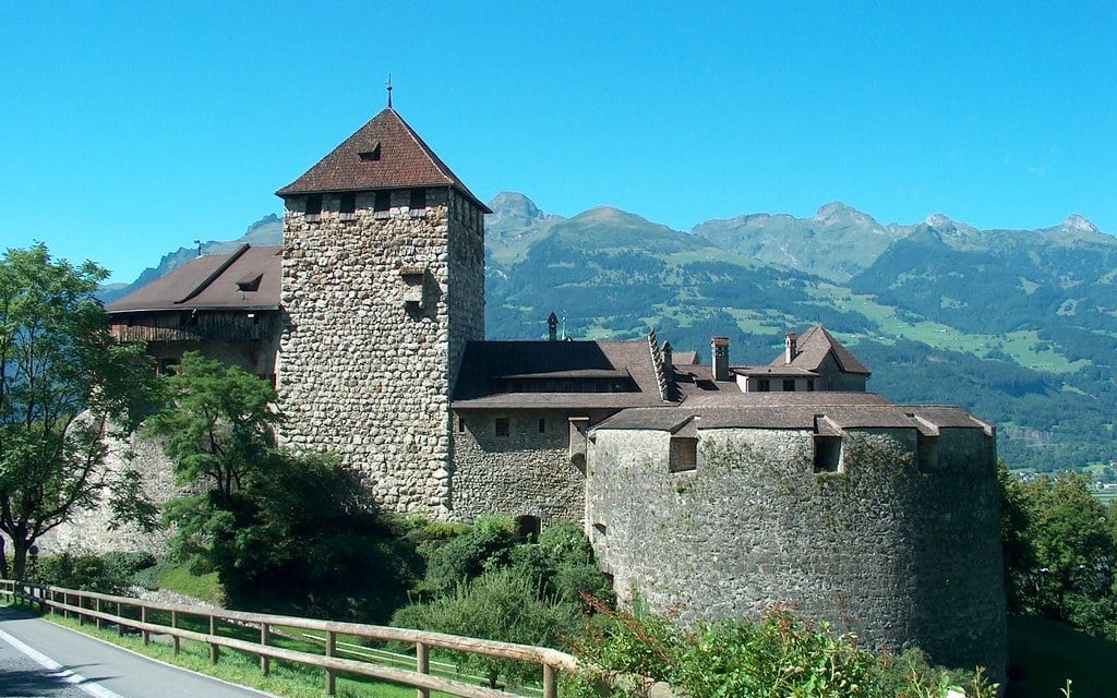
Vaduz Castle with Alpine peaks behind it in Liechtenstein.
ghentooo · CC BY 2.0Cropped to 16:10.
Landlocked · Europe

Liechtenstein

Landlocked—and so are all its neighbours.

Liechtenstein sits between Switzerland and Austria in the Alps. Both neighbours are landlocked too, making the principality doubly landlocked.

Open field notes

Life across the line

Small countries depend on connections beyond their borders. Liechtenstein’s location invites a different question from “How big is it?”: how do neighbouring countries shape its routes to the wider world?

  1. 1719

    Vaduz and Schellenberg are united as the principality.

  2. 1806

    Liechtenstein becomes sovereign.

  3. Today

    It borders Switzerland and Austria, both without an ocean coastline.

Landlocked does not mean enclosed by just one country. Liechtenstein has two neighbours.

Compare Liechtenstein & Switzerland ↗
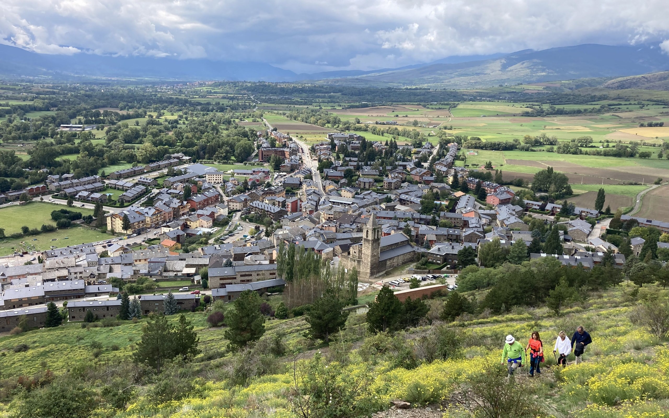
Llívia's stone houses and church spread across the Cerdanya valley, seen from the castle hill with the Pyrenees beyond.
Medol via Wikimedia Commons · CC BY-SA 4.0Cropped to 16:10. This adaptation is shared under CC BY-SA 4.0.
Enclaves · Europe

Llívia

The town that a treaty did not turn into a village.

Llívia is a Spanish municipality surrounded by France in the Cerdanya valley of the Pyrenees. Its unusual position grew from the settlements following the Treaty of the Pyrenees: villages were transferred to France, while Llívia retained its status as a town and remained Spanish.

Open field notes

Life across the line

For residents, this is a lived-in Catalan town, not simply a hole in a map. The valley’s routes, shops and family connections cross a national boundary, while the municipal museum explains the enclave’s history alongside its celebrated old pharmacy collection.

  1. 1659

    The Treaty of the Pyrenees establishes the framework for territorial changes.

  2. 1660

    The Llívia settlement identifies the Cerdanya villages transferred to France; Llívia remains Spanish.

  3. Today

    The enclave retains its Spanish administration within a shared Pyrenean valley.

Treaty language and a settlement’s legal status can leave a visible footprint on the map centuries later.

Compare Spain & France ↗
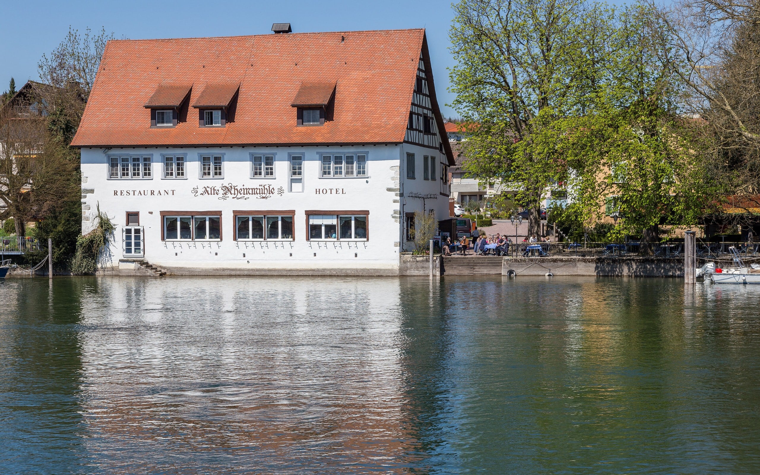
The Alte Rheinmühle, a 17th-century former mill now a hotel, on the Rhine in the German enclave of Büsingen.
JoachimKohler-HB via Wikimedia Commons · CC BY-SA 4.0Cropped to 16:10. This adaptation is shared under CC BY-SA 4.0.
Enclaves · Europe

Büsingen am Hochrhein

German territory. Swiss customs. One riverside community.

Büsingen is a German municipality completely surrounded by Switzerland. Its residents live under German sovereignty, but the enclave belongs to the Swiss customs area—a reminder that political and economic borders need not follow the same line.

Open field notes

Life across the line

An ordinary shopping trip can involve rules that neighbours elsewhere never consider. The municipality publishes practical guidance on customs and everyday questions because being German does not make Büsingen part of Germany’s customs territory.

  1. 1964

    Germany and Switzerland sign the customs-area treaty.

  2. 1967

    The treaty enters into force.

  3. Today

    German local government and Swiss customs arrangements coexist.

Sovereignty, customs and everyday economic connections are separate layers of geography.

Compare Germany & Switzerland ↗
Wooded Pheasant Island reflected in the calm Bidasoa river at Behobia, between Spain and France.
Iñaki LL via Wikimedia Commons · CC BY-SA 4.0Cropped to 16:10. This adaptation is shared under CC BY-SA 4.0.
Diplomacy · Europe

Pheasant Island

An island whose administrators take turns.

On the Bidasoa River between Hendaye and Irun, tiny Pheasant Island is shared by France and Spain. Its administration alternates every six months, while its underlying status remains a joint sovereignty arrangement known as a condominium.

Open field notes

Life across the line

The human story is on the neighbouring riverbanks: maintenance, official handovers and local memory keep an unusual diplomatic arrangement alive. The island is normally closed to the public; seeing it from shore is not permission to land.

  1. 1659

    The Treaty of the Pyrenees is signed on the island.

  2. February–July

    Spain takes its recurring administrative turn.

  3. August–January

    France takes its recurring administrative turn.

A condominium means shared sovereignty. Alternating administration does not mean the island stops being jointly held.

Compare France & Spain ↗
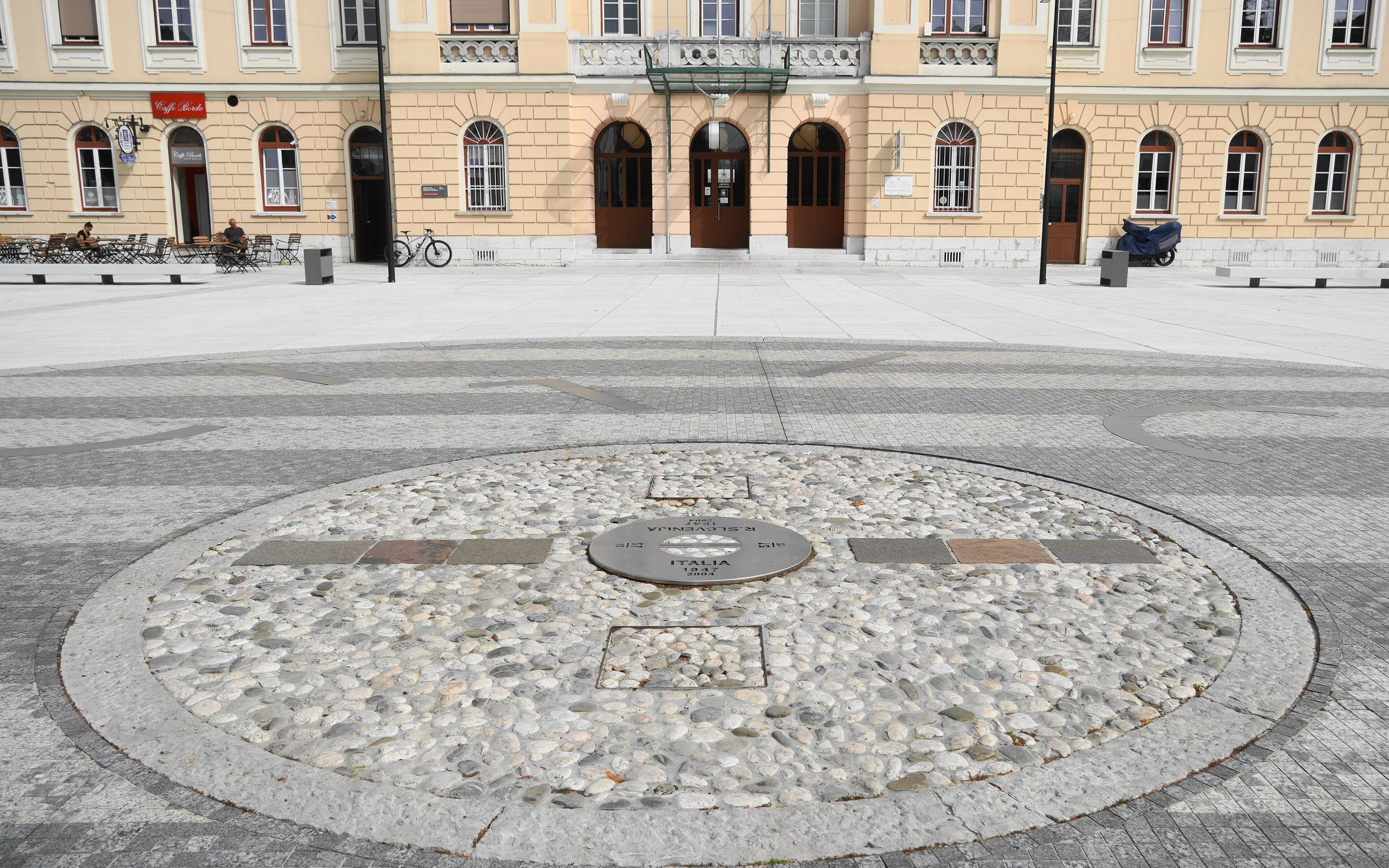
The circular border marker in Transalpina Square / Trg Evrope, with Nova Gorica railway station behind.
Naturpuur via Wikimedia Commons · CC BY-SA 4.0Cropped to 16:10. This adaptation is shared under CC BY-SA 4.0.
Shared communities · Europe

Gorizia & Nova Gorica

The station square that became a meeting place again.

Piazza Transalpina / Trg Evrope lies across the Italian–Slovenian boundary beside Nova Gorica’s railway station. A space once divided by a fence became a symbol of cooperation between Gorizia and Nova Gorica.

Open field notes

Life across the line

A railway station can face one country while its neighbours live in another. Renewing the square gives residents a shared space without erasing different languages or difficult memories. National borders remain, even where the old fence has gone.

  1. 1947

    The post-war boundary divides the station forecourt.

  2. 2004

    The fence in the square is removed as Slovenia joins the European Union.

  3. 2025

    The renewed square becomes a focal point of the joint European Capital of Culture programme.

Removing a physical barrier and building a shared civic life are different steps—and both can matter.

Compare Italy & Slovenia ↗
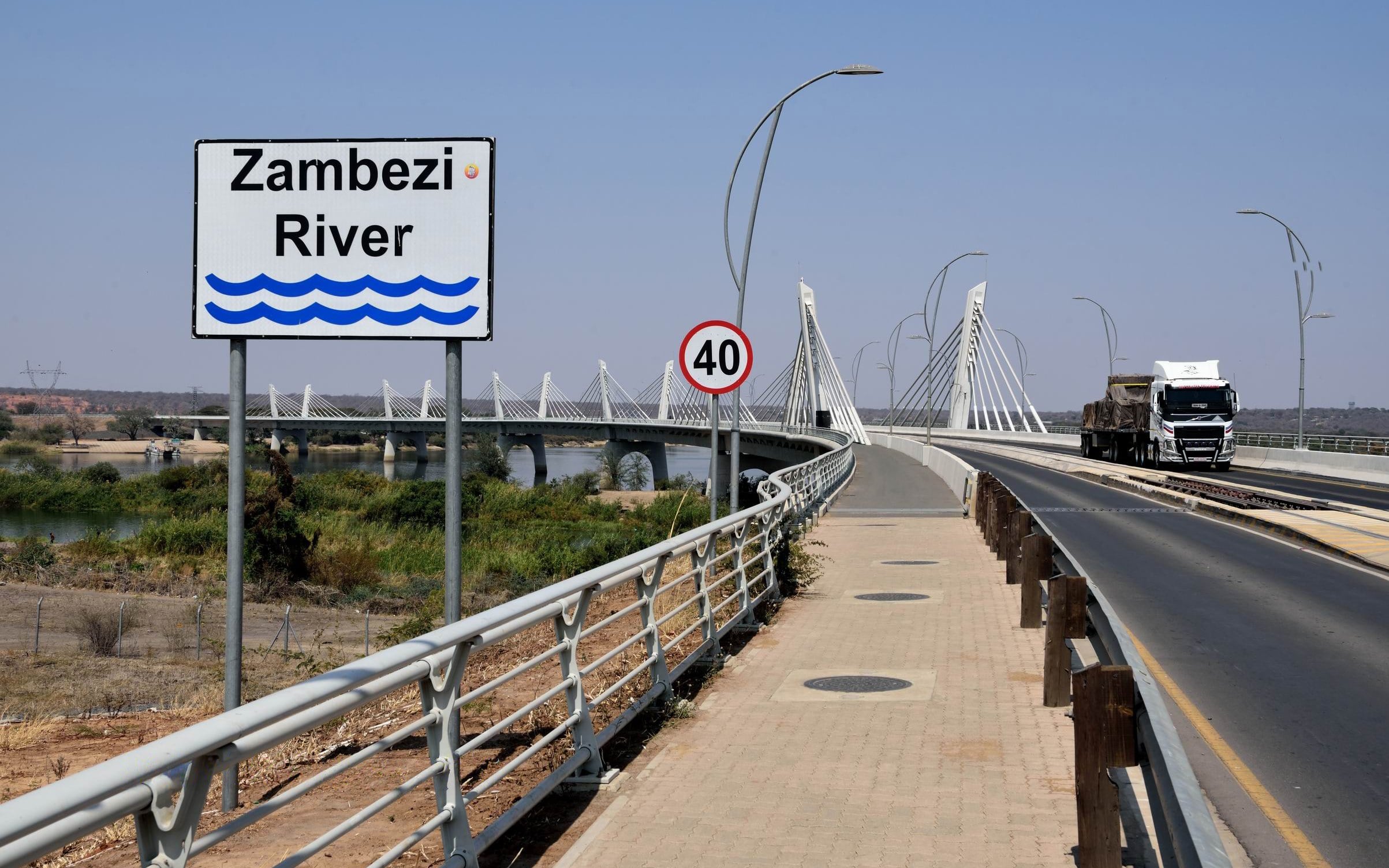
A 'Zambezi River' sign at the Kazungula Bridge, with a lorry crossing the curved cable-stayed bridge.
Matthias Hille (Matthias-Tf) via Wikimedia Commons · CC BY-SA 4.0Cropped to 16:10. This adaptation is shared under CC BY-SA 4.0.
River crossings · Africa

Kazungula

Four countries nearby—but not one four-country corner.

Around Kazungula, Botswana, Zambia, Namibia and Zimbabwe come remarkably close together. The famous map puzzle is not a simple four-country point: Botswana and Zambia share a short river boundary, crossed by the Kazungula Bridge.

Open field notes

Life across the line

For truck drivers, traders and communities linked to regional markets, a border is also waiting time, paperwork and reliable transport. The bridge and its one-stop border facilities were designed to improve that connection, not simply create a sightseeing landmark.

  1. Ferry era

    Vehicles depend on ferries for the Botswana–Zambia crossing.

  2. 10 May 2021

    The Kazungula Bridge is officially opened.

  3. Regional connection

    The crossing links national road networks and wider southern African trade routes.

A dramatic map corner deserves careful reading: four nearby countries do not automatically make a quadripoint.

Compare Botswana & Zambia ↗
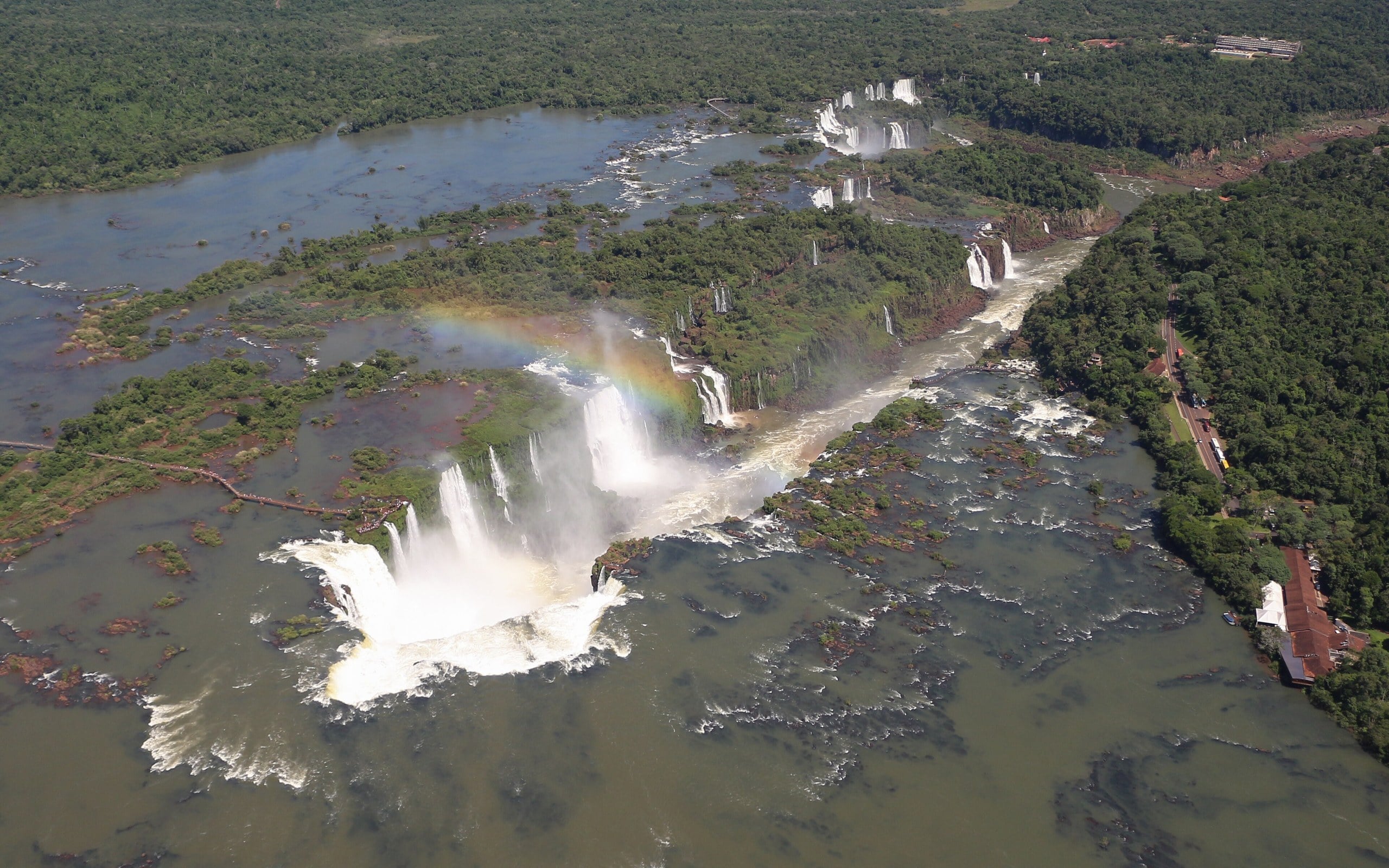
Aerial view of Iguazú Falls and the Devil's Throat, with a rainbow over the mist, on the Argentina–Brazil border.
Bernard Gagnon via Wikimedia Commons · CC BY-SA 4.0Cropped to 16:10. This adaptation is shared under CC BY-SA 4.0.
River crossings · South America

Iguazú / Iguaçu

Two countries. Two spellings. One living waterfall landscape.

The Iguazú River forms part of the boundary between Argentina and Brazil, including the great waterfall system. On each bank, a national park protects part of the same Atlantic Forest landscape—but the parks are separately administered.

Open field notes

Life across the line

Rangers, guides and neighbouring communities live with a landscape whose water and wildlife cross jurisdictional lines. Upstream changes and forest fragmentation do not stop at a passport checkpoint, so conservation must look beyond each park’s national outline.

  1. 1984

    Argentina’s Iguazú National Park is inscribed by UNESCO.

  2. 1986

    Brazil’s Iguaçu National Park is inscribed separately.

  3. Today

    The neighbouring parks protect connected forest and waterfall habitats.

A river may divide administration while connecting an ecosystem. Shared nature does not mean a single jointly administered park.

Compare Argentina & Brazil ↗
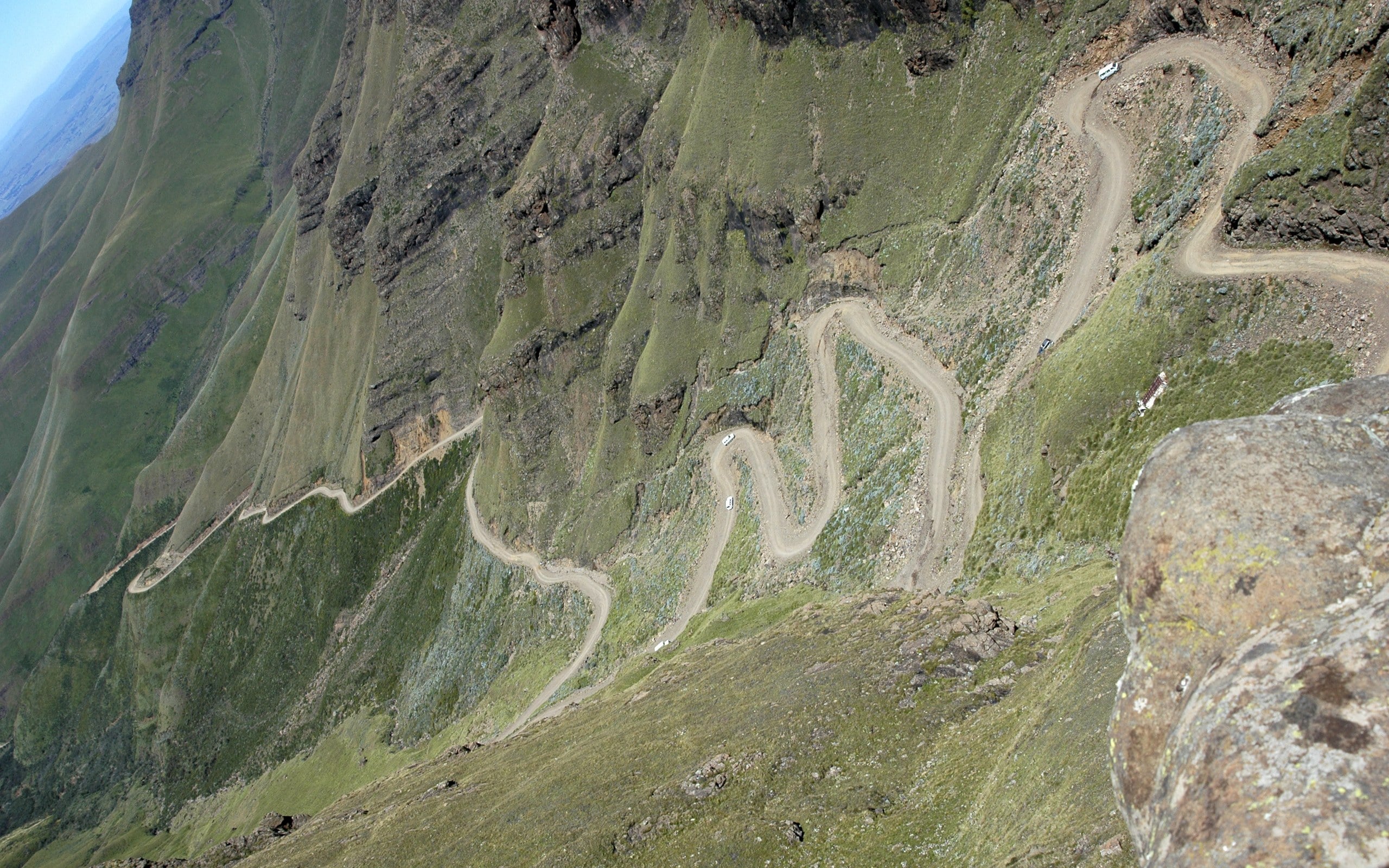
The Sani Pass gravel road zigzags up the steep green Drakensberg escarpment towards Lesotho.
Amada44 via Wikimedia Commons · Public domain (PD-self, released by the author)Historical view photographed in 2007. Cropped to 16:10. Public-domain photograph.
Landlocked · Africa

Sani Pass & Lesotho

A mountain road into a country inside another country.

Sani Pass climbs the Drakensberg escarpment towards Lesotho, an independent kingdom completely surrounded by South Africa. The dramatic mountain approach makes an abstract fact—an entire country enclosed by one neighbour—feel tangible.

Open field notes

Life across the line

For Basotho communities and people working along the route, the pass is about access, trade and livelihoods as well as spectacular scenery. Weather and border requirements shape journeys. This story is not a road-condition report or permission to cross.

  1. Pack-animal route

    Trade follows the steep path between the highlands and lowlands.

  2. 1948

    The first recorded motor-vehicle ascent marks a new chapter for the route.

  3. 1966

    Lesotho becomes independent, remaining surrounded by South Africa.

A border control building need not stand exactly on the legal boundary. Lesotho is landlocked, but not doubly landlocked: South Africa has an ocean coast.

Compare Lesotho & South Africa ↗
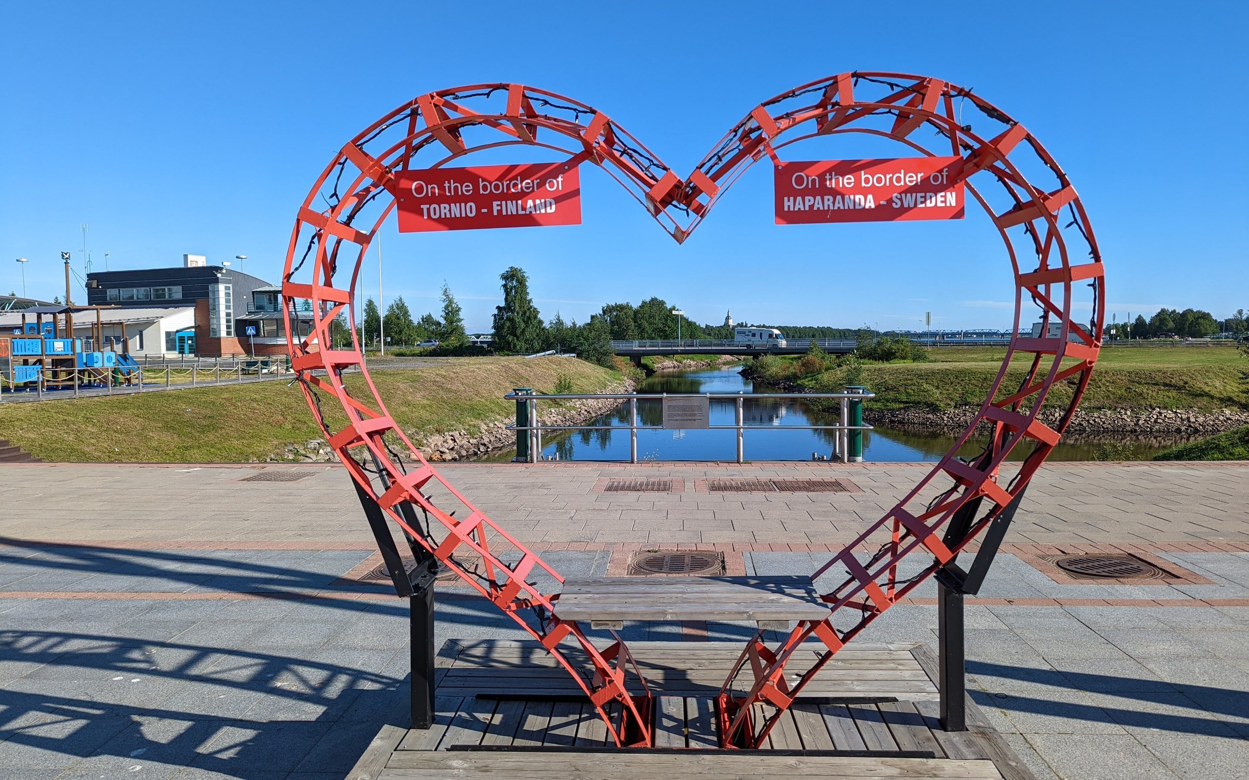
A red heart sculpture labelled 'On the border of Tornio – Finland' and 'Haparanda – Sweden' on the shared waterfront.
AleWi via Wikimedia Commons · CC BY-SA 4.0Cropped to 16:10. This adaptation is shared under CC BY-SA 4.0.
Water & time · Europe

Haparanda & Tornio

Neighbours across a border—and an hour apart.

Swedish Haparanda and Finnish Tornio form a closely connected pair of northern towns. Cross the national boundary and local time changes: Finland is one hour ahead of Sweden under their current time-zone arrangements.

Open field notes

Life across the line

Appointments, shopping and celebrations can require thinking about which side’s clock someone means. Finnish, Swedish and the regional language Meänkieli reflect a cultural landscape older and more layered than the modern line.

  1. 1809

    The peace settlement creates a new boundary after Finland is ceded by Sweden to Russia.

  2. 19th century

    Haparanda develops beside Tornio across the new boundary.

  3. Today

    The neighbouring towns cooperate across two national time zones.

A time-zone border can be part of daily neighbourhood life, not just a problem for long-distance travellers.

Compare Sweden & Finland ↗
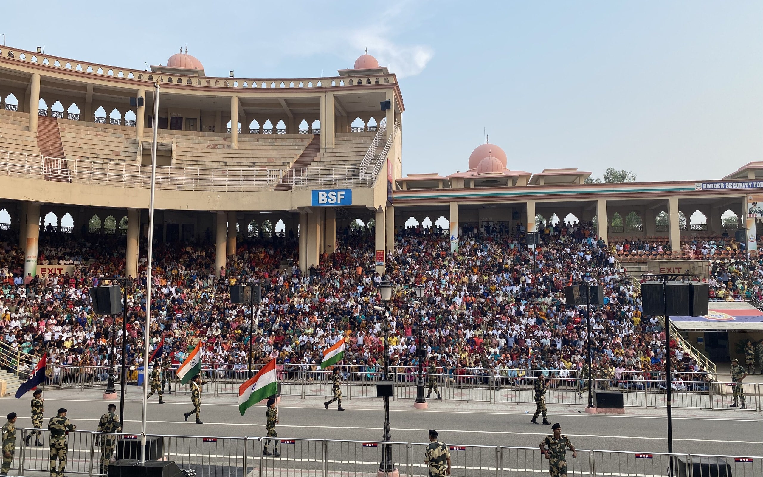
Indian Border Security Force soldiers carry flags before packed stands during the Attari–Wagah evening ceremony.
Vinayaraj via Wikimedia Commons · CC BY-SA 4.0Cropped to 16:10. This adaptation is shared under CC BY-SA 4.0.
Shared communities · Asia

Wagah–Attari

A ceremony at a line that changed millions of lives.

Between Amritsar and Lahore, Attari on the Indian side and Wagah on the Pakistani side face one another across a border created by Partition in 1947. The flag-lowering ceremony is famous, but the line’s history is far larger than the spectacle.

Open field notes

Life across the line

Crowds may see marching and flags, while families remember migration, loss and relationships across the line. Presenting both perspectives avoids turning a deeply consequential border into only a colourful performance.

  1. 1947

    Partition establishes the India–Pakistan boundary through Punjab.

  2. 1959

    The joint retreat ceremony tradition begins.

  3. Visitor guidance

    Consult the border authorities for current arrangements rather than relying on old photographs or schedules.

Attending a border ceremony and receiving permission to cross into another country are entirely different things.

Compare India & Pakistan ↗
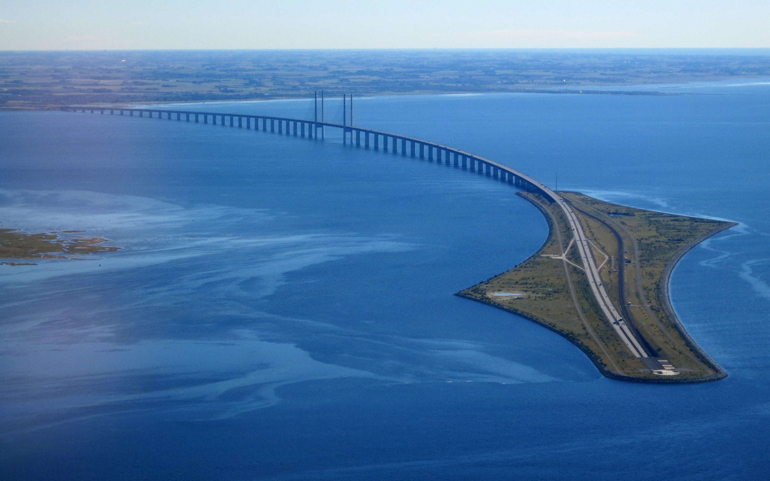
Aerial view of the Øresund Bridge running to the artificial island of Peberholm, where the link enters the tunnel to Denmark.
Nick-D via Wikimedia Commons · CC BY-SA 4.0Cropped to 16:10. This adaptation is shared under CC BY-SA 4.0.
Water & time · Europe

The Øresund Crossing

The bridge that becomes an island—and then a tunnel.

The fixed link between the Copenhagen and Malmö areas is more than a bridge. It combines a bridge, the artificial island of Peberholm and an immersed tunnel, carrying road and rail traffic between Denmark and Sweden.

Open field notes

Life across the line

A commute can cross the sea and a national frontier without changing trains into a ferry. Yet residence, work and national rules still matter. The crossing shows how infrastructure can bring places closer while leaving political geography intact.

  1. 1995

    Construction begins on the coast-to-coast link.

  2. 1 July 2000

    The Øresund link is inaugurated.

  3. Today

    Road and rail connect the Danish and Swedish sides through bridge, island and tunnel.

A fixed link can transform distance in daily life without removing the national border it crosses.

Compare Denmark & Sweden ↗
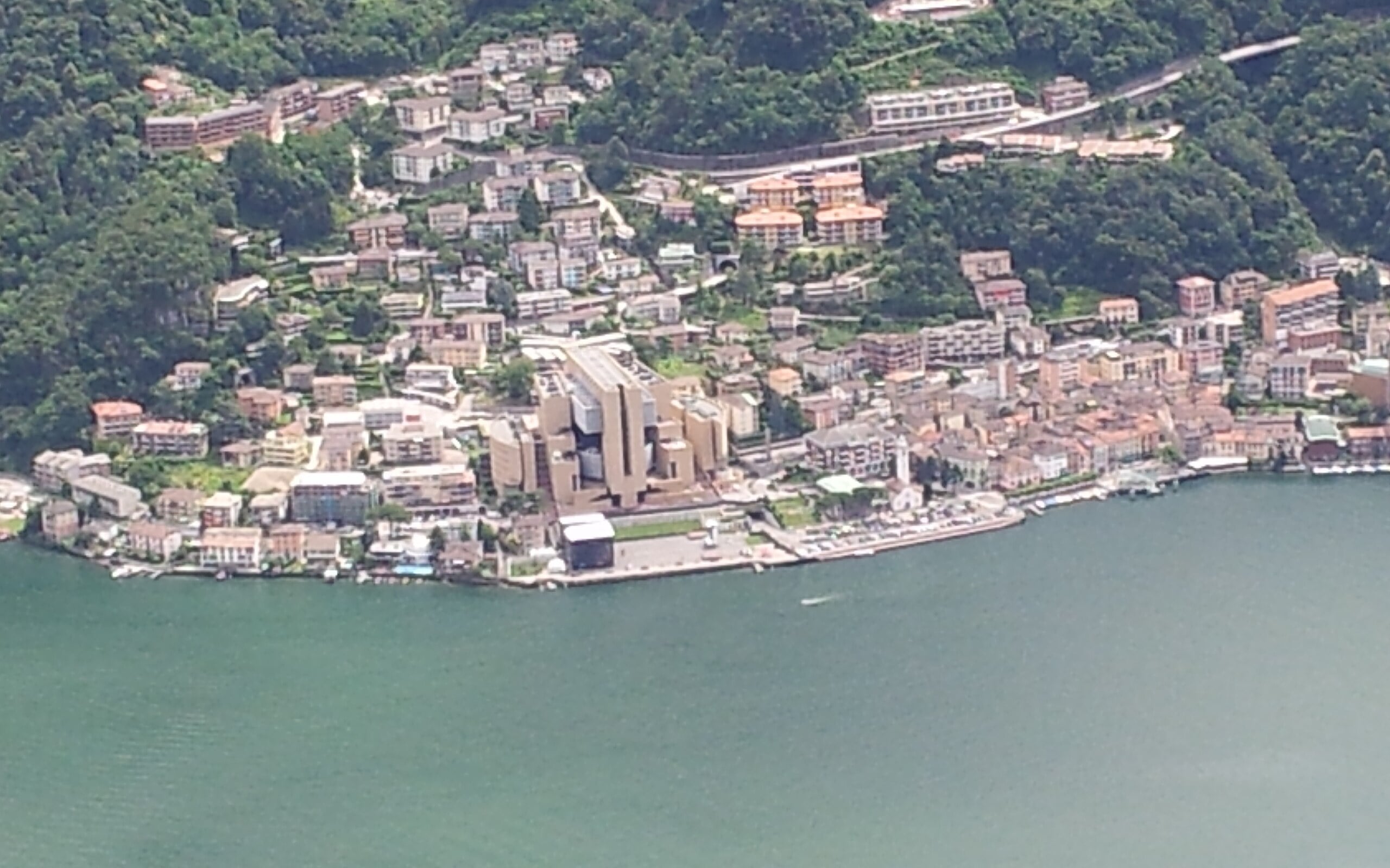
Campione d'Italia on the shore of Lake Lugano seen from Monte San Salvatore, with Swiss mountains behind
AxelBoldt via Wikimedia Commons · CC0Campione d'Italia, the Italian enclave on Lake Lugano, seen from Monte San Salvatore, Switzerland (2014). Cropped to 16:10.
Enclaves · Europe

Campione d’Italia

An Italian lakeside town with Switzerland at its doorstep.

On Lake Lugano, Campione belongs to Italy but is surrounded by the Swiss canton of Ticino. The nearby Italian mainland looks close on a map; mountains make the road journey run through Switzerland instead.

Open field notes

Life across the line

Residents live in an Italian municipality while depending on cross-border routes for many journeys. A short distance measured across a lake is not the same as a practical road connection.

  1. Before 2020

    Campione operated outside the EU customs territory, closely integrated with surrounding Switzerland.

  2. 2020

    The enclave entered the EU customs territory.

  3. Today

    Italian sovereignty and its Swiss geographical setting coexist.

A customs boundary can change while the national border stays put.

Compare Italy & Switzerland ↗

Read the sources

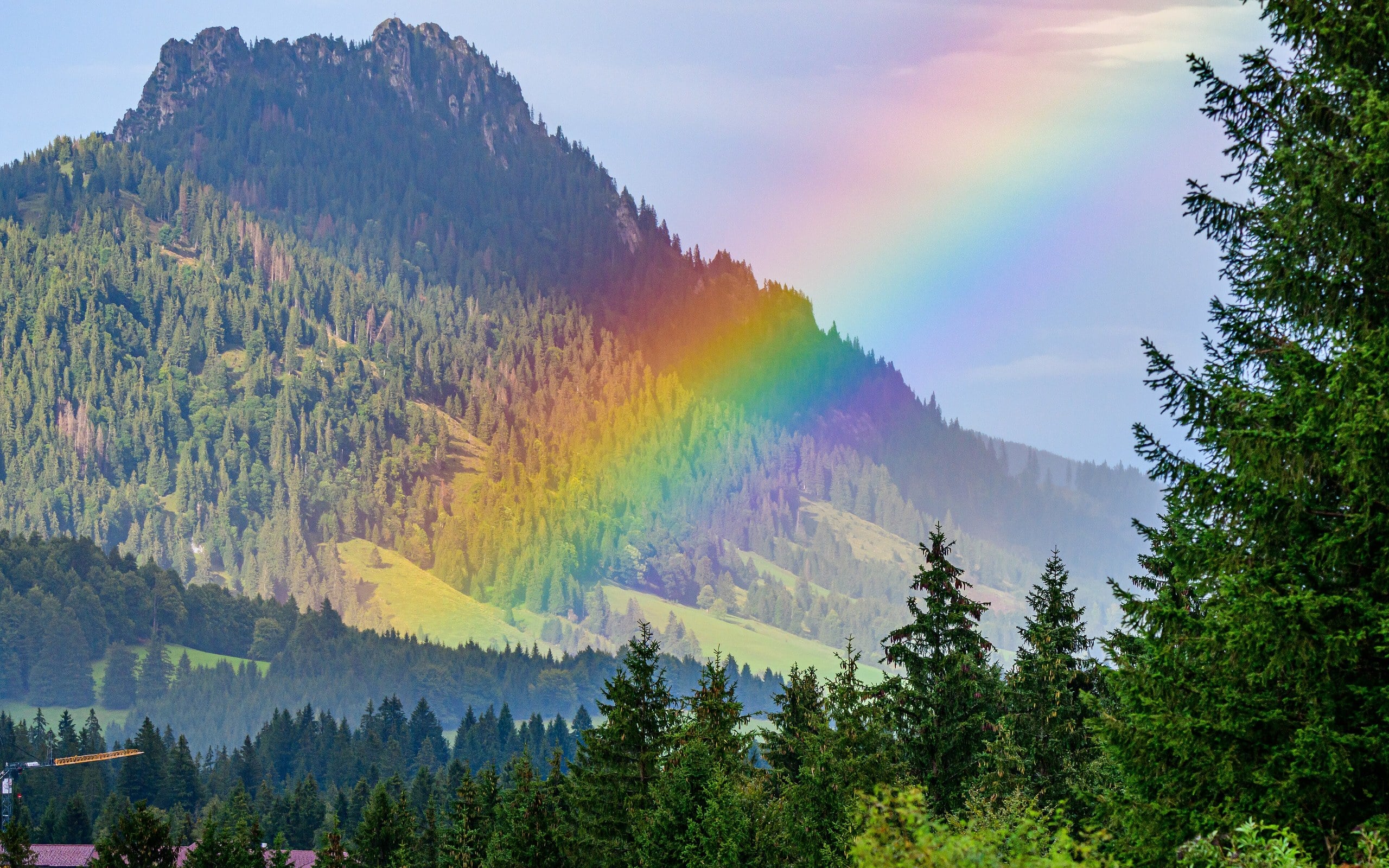
The Sorgschrofen summit above green Alpine meadows with a rainbow over the slope
Stephan Sprinz via Wikimedia Commons · CC BY 4.0The Sorgschrofen (Tyrol/Bavaria), whose summit is the single point linking Jungholz to the rest of Austria (2022). The village itself is not shown. Cropped to 16:10.
Disconnected territory · Europe

Jungholz

Connected to home at a mountain summit—not by a road.

Jungholz is Austrian, but its road access is through Germany. At the Sorgschrofen summit its territory touches the rest of Austria at a single point: a striking difference between a legal connection and a usable route.

Open field notes

Life across the line

Tourists arrive through Bavaria even though they are heading to an Austrian village. Addresses can use Austrian or German postal codes, reflecting a community whose services developed around geography.

  1. Before EU integration

    German customs connections reflected the village’s road access.

  2. 1995

    Austria joined the European Union.

  3. 2002

    Euro notes and coins replaced the Deutsche Mark used locally.

A point of contact on a map cannot carry a normal road.

Compare Austria & Germany ↗

Read the sources

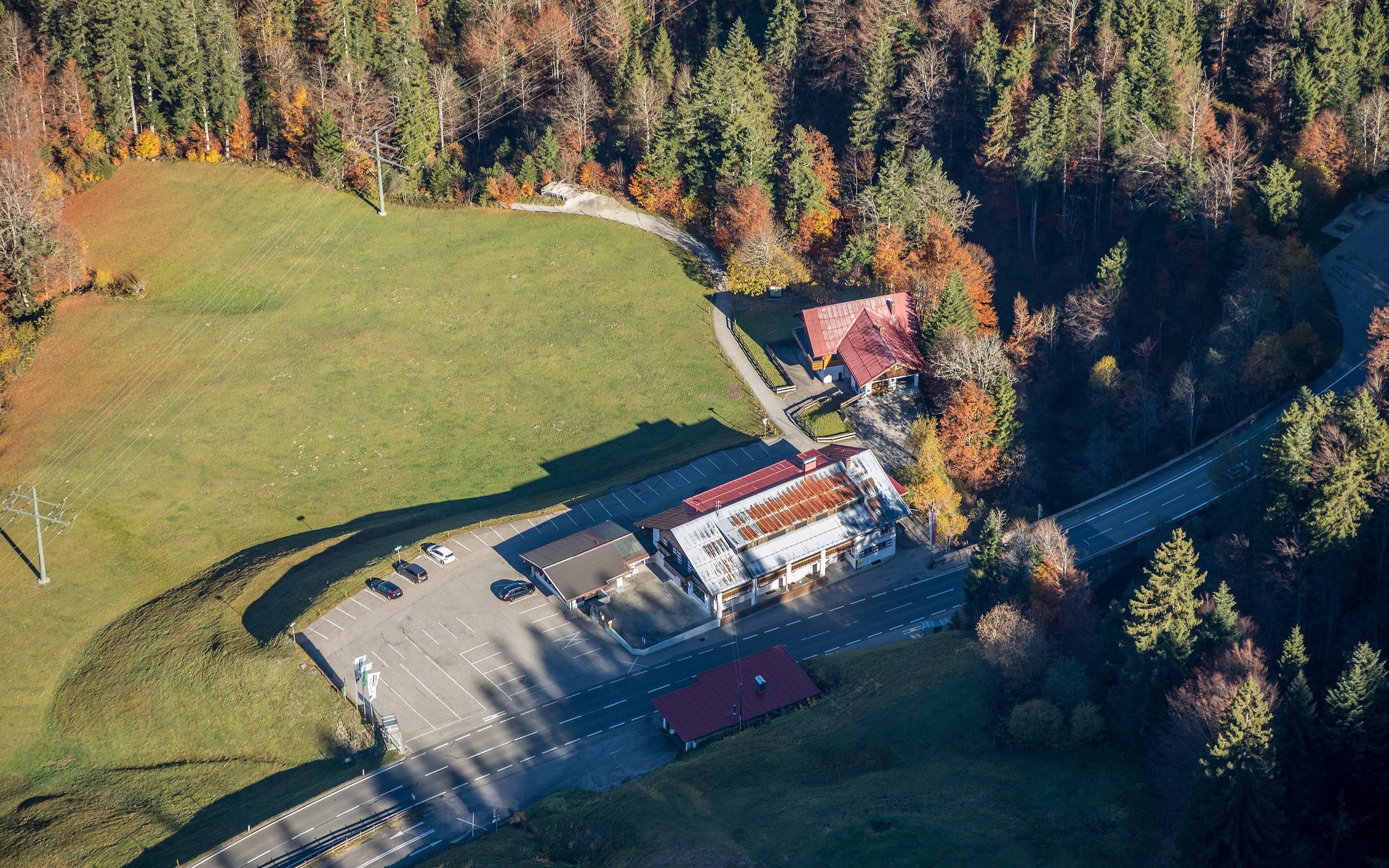
Oblique aerial view of the Walserschanz road crossing between Riezlern, Austria, and Oberstdorf, Germany, in a green Alpine valley
Herbert Heim via Wikimedia Commons · CC BY-SA 4.0Aerial view of the Walserschanz, where the only road into Austria's Kleinwalsertal enters from Germany (2017). Cropped to 16:10. This adaptation is shared under CC BY-SA 4.0.
Disconnected territory · Europe

Kleinwalsertal

A valley whose road points into a different country.

Kleinwalsertal is an Austrian valley in Vorarlberg, but the ordinary road approach is from Oberstdorf in Germany. Alpine ridges, rather than a detached patch of sovereignty, explain this practical exclave.

Open field notes

Life across the line

For a delivery driver or a family heading to a ski holiday, the valley’s entrance matters more than the shortest line to the Austrian interior. Mountain trails do not substitute for an all-purpose road.

  1. 1891

    A customs arrangement strengthened the valley’s economic connection to Germany.

  2. 1995

    Austria joined the EU.

  3. Today

    The road approach still comes from the German side of the Alps.

Physical accessibility and political belonging answer different questions.

Compare Austria & Germany ↗

Read the sources

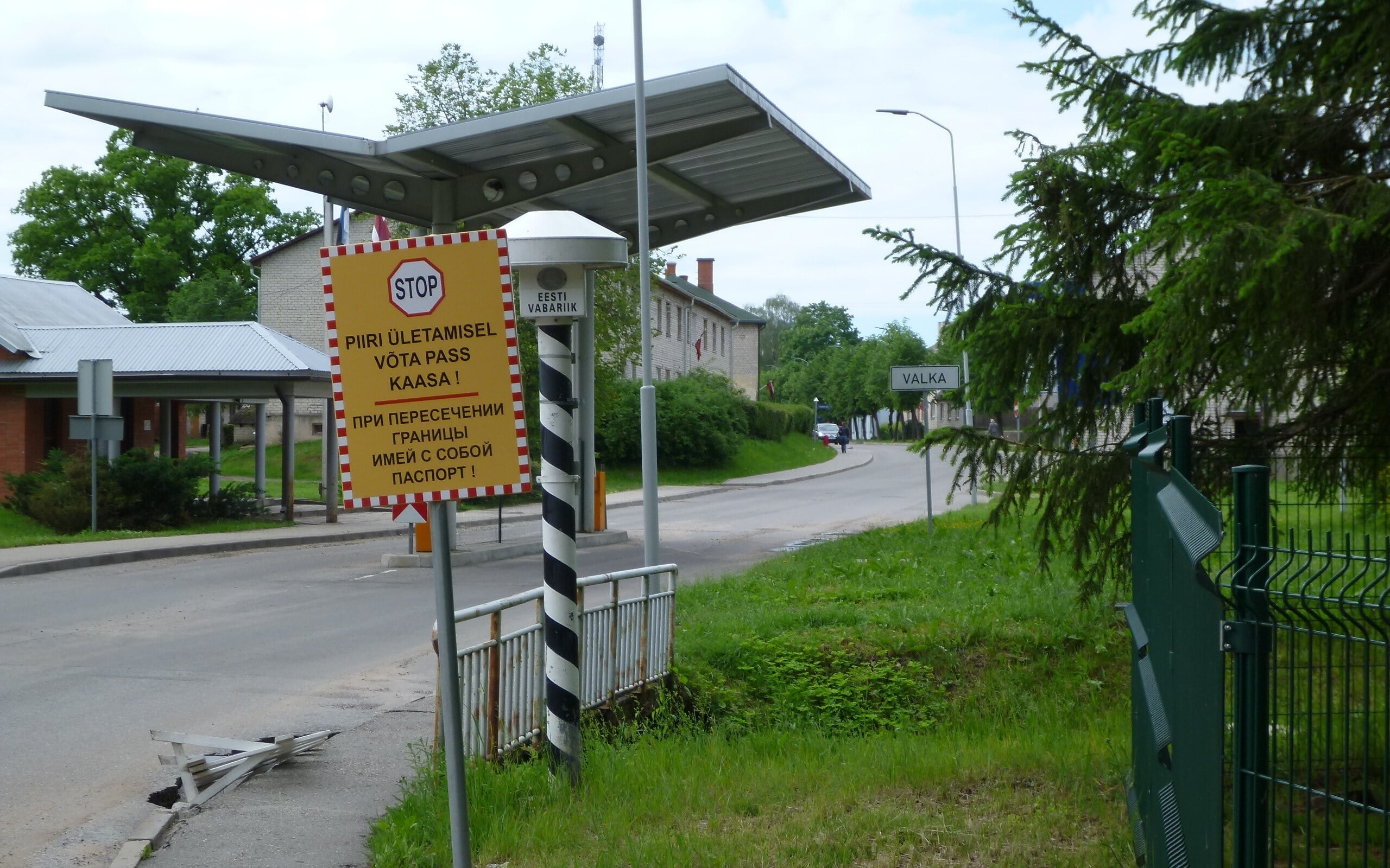
Border post and sign on a street between Valga, Estonia, and Valka, Latvia
Vesahjr via Wikimedia Commons · CC BY-SA 3.0Border marker between Valga (Estonia) and Valka (Latvia), seen from the Estonian side (2014). Cropped to 16:10. This adaptation is shared under CC BY-SA 3.0.
Shared communities · Europe

Valga & Valka

One old town became two—and learned to reconnect.

Valga in Estonia and Valka in Latvia were once a single town. Their division in 1920 placed an international boundary through a familiar urban landscape rather than between distant settlements.

Open field notes

Life across the line

Neighbours can share public spaces and cross-border projects while using different national institutions and languages. An open-looking street does not erase the distinction between the two states.

  1. 1920

    The town was divided between Estonia and Latvia.

  2. 2007

    Schengen entry removed routine border-crossing barriers.

  3. Today

    The twin towns pursue cross-border connections.

A divided town can cooperate without becoming one municipality again.

Compare Estonia & Latvia ↗

Read the sources

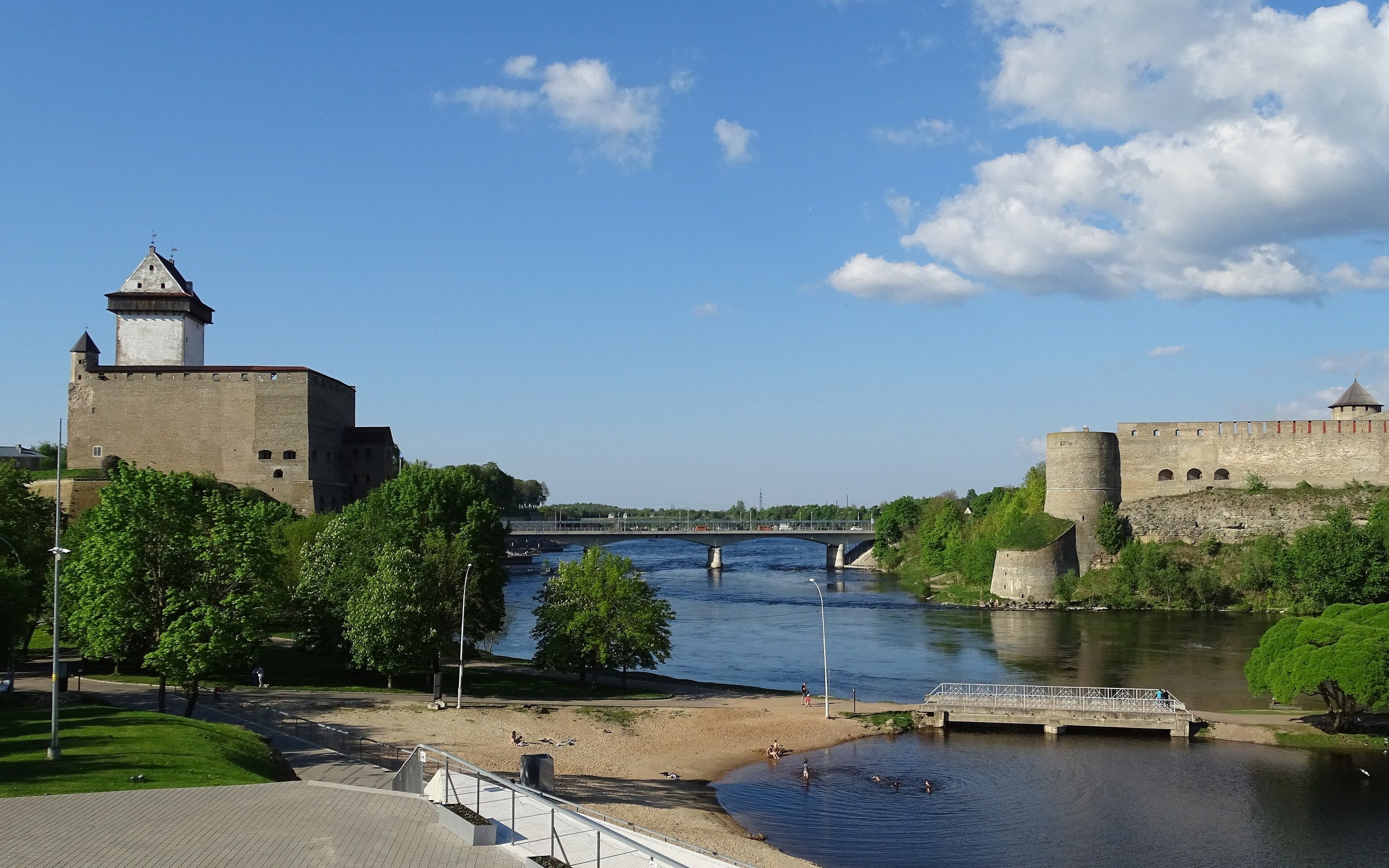
Narva's Hermann Castle and Russia's Ivangorod Fortress facing each other across the Narva River
Ad Meskens via Wikimedia Commons · CC BY-SA 4.0Hermann Castle in Narva, Estonia (left) and Ivangorod Fortress, Russia, across the Narva River (2018). Cropped to 16:10. This adaptation is shared under CC BY-SA 4.0.
Shared communities · Europe

Narva & Ivangorod

Two fortresses look across one river—and an external EU frontier.

Narva’s castle and Ivangorod’s fortress face each other across the Narva River. The view is exceptionally close, yet it spans the boundary between Estonia and Russia.

Open field notes

Life across the line

Family, language and historical connections can persist across a heavily regulated frontier. Crossing conditions change, so a scenic photograph must not be read as a statement that a bridge is open.

  1. Historic frontier

    Facing fortifications developed on opposite riverbanks.

  2. 1991

    Estonia restored independence as the Soviet Union dissolved.

  3. Today

    The river separates Estonia and Russia at a regulated frontier.

Visual closeness tells you little about legal access.

Compare Estonia & Russia ↗
The Olza River between Český Těšín and Cieszyn seen from the Freedom Bridge
Marcin Konsek via Wikimedia Commons · CC BY-SA 4.0The Olza River, the Czech–Polish border, seen from the Freedom Bridge between Český Těšín and Cieszyn (2012). Cropped to 16:10. This adaptation is shared under CC BY-SA 4.0.
Shared communities · Europe

Cieszyn & Český Těšín

A river bridge links two halves of a shared urban history.

The Olza River runs between Polish Cieszyn and Czech Český Těšín. Before the post-First World War partition, the two banks belonged to the same town, historically known as Teschen.

Open field notes

Life across the line

The historic centre and railway-side districts developed into neighbouring national urban centres. Cultural connections coexist with different official languages and administrations.

  1. 1918

    Austria-Hungary collapsed; competing claims followed.

  2. 1920

    The town was partitioned along the Olza.

  3. Today

    Bridges connect the Polish and Czech towns.

A bridge may preserve a community’s connections even after a boundary changes its address.

Compare Poland & Czechia ↗
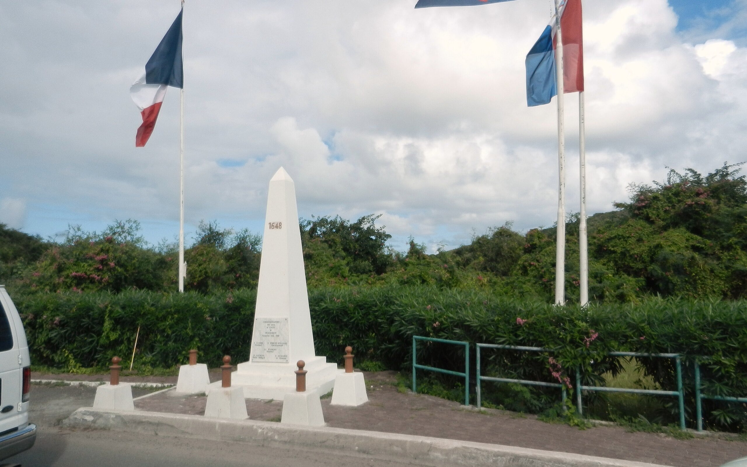
White border obelisk with French flags beside a road on Saint Martin
Michael A. Orlando via Wikimedia Commons · CC BY-SA 3.0Border monument on the road between French Saint-Martin and Dutch Sint Maarten (2012). Cropped to 16:10. This adaptation is shared under CC BY-SA 3.0.
Shared communities · North America

Saint-Martin & Sint Maarten

A Caribbean island with a French–Dutch land boundary.

The island of Saint Martin is shared between the French collectivity of Saint-Martin and Sint Maarten, a constituent country of the Kingdom of the Netherlands. The international boundary lies in the Caribbean—not in continental Europe.

Open field notes

Life across the line

Roads, tourism and family connections cross the island’s division. Different institutions can share a small geographical space, while immigration and entry rules still apply.

  1. 1648

    The Treaty of Concordia established the French–Dutch division.

  2. Modern arrangement

    The north is a French collectivity; the south is a country within the Kingdom of the Netherlands.

Overseas geography can put European states next to each other far from Europe.

Compare Saint Martin & Sint Maarten ↗
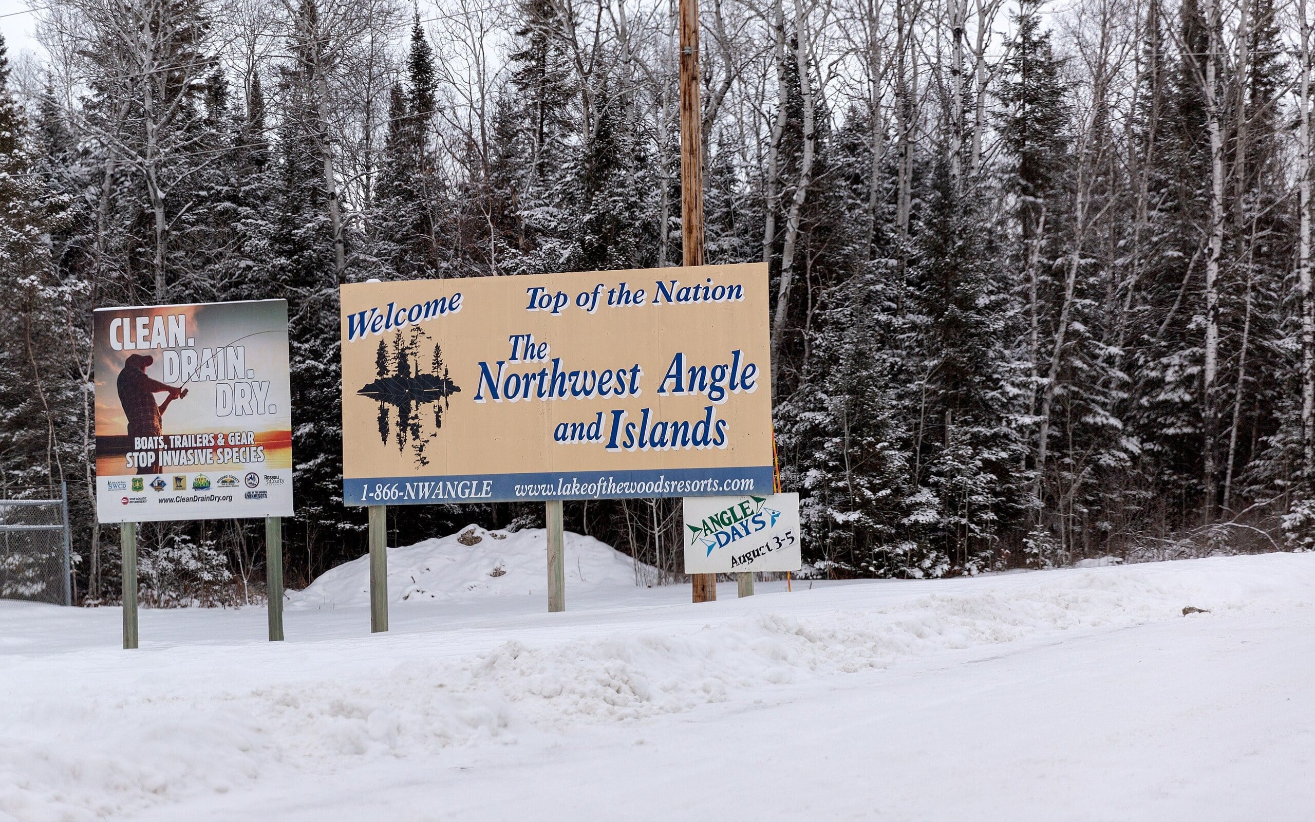
Snow-covered 'Welcome to the Northwest Angle and Islands' sign beside a winter road in Minnesota
Lorie Shaull via Wikimedia Commons · CC BY-SA 4.0Welcome sign at the Northwest Angle, Minnesota, the US land reachable by road only through Canada (2018). Cropped to 16:10. This adaptation is shared under CC BY-SA 4.0.
Disconnected territory · North America

The Northwest Angle

A treaty’s lake reference left Minnesota with a northern surprise.

The Northwest Angle sits above the 49th parallel beside Lake of the Woods. Its mainland road connection to the rest of Minnesota passes through Manitoba in Canada; the lake separates it from the rest of the state.

Open field notes

Life across the line

Road journeys involve an international frontier even when both the start and destination are American. Water travel and roads offer different geographical connections, not identical immigration procedures.

  1. 1783

    The Treaty of Paris used Lake of the Woods and the Mississippi to describe the boundary.

  2. 1818

    A later agreement linked the lake to the 49th parallel.

  3. Today

    The Angle remains a practical exclave of Minnesota.

Treaties need accurate geography as well as precise words.

Compare United States & Canada ↗
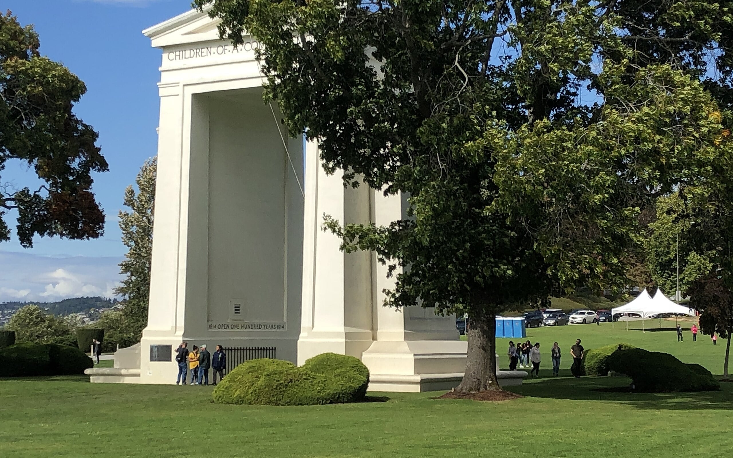
The white Peace Arch on lawns at the US–Canada border, viewed toward the northwest
Peaceart21 via Wikimedia Commons · CC BY-SA 4.0The Peace Arch on the Washington–British Columbia border, viewed northwest from the US side (2018). Cropped to 16:10. This adaptation is shared under CC BY-SA 4.0.
Diplomacy · North America

The Peace Arch

A monument built on the line, rather than safely beside it.

The Peace Arch stands on the Canada–United States boundary between Blaine, Washington, and the Surrey area of British Columbia. Its position makes international friendship part of the monument’s physical design.

Open field notes

Life across the line

Visitors see a shared memorial in a landscape managed by two countries. Park arrangements must not be confused with permission to travel onward across the border.

  1. 1814

    The Treaty of Ghent ended the War of 1812.

  2. 1921

    The Peace Arch was dedicated.

  3. Today

    The monument stands at an active international crossing.

A border monument can express cooperation instead of conquest.

Compare United States & Canada ↗
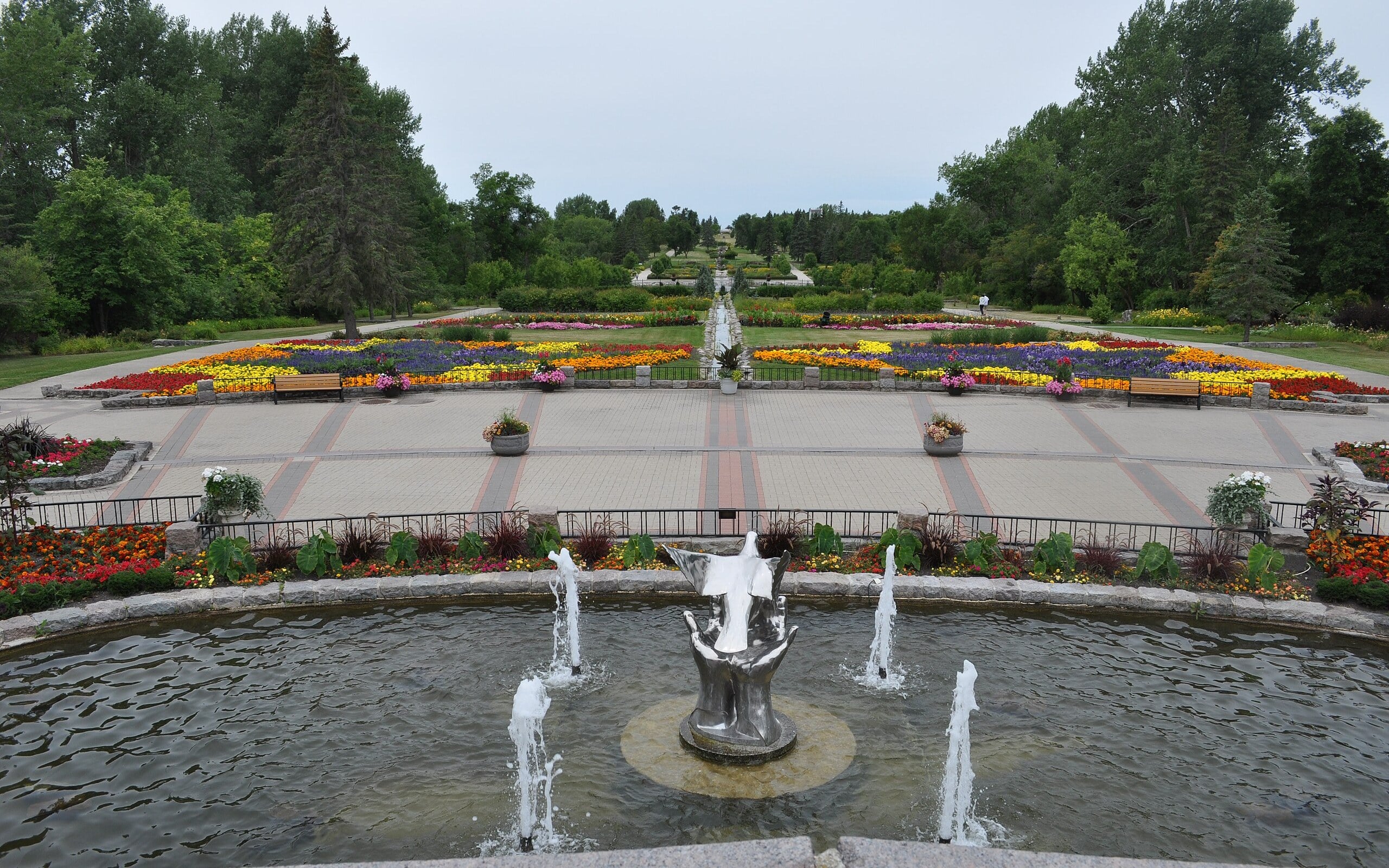
Fountain and formal flower beds along the central axis of the International Peace Garden
Dig deeper via Wikimedia Commons · CC BY-SA 4.0The International Peace Garden straddling the Manitoba–North Dakota border; Canada is on the right, the US on the left (2018). Cropped to 16:10. This adaptation is shared under CC BY-SA 4.0.
Diplomacy · North America

The International Peace Garden

A garden planted across an international boundary.

Between Manitoba and North Dakota, the International Peace Garden turns the border into the centre of a shared landscape. Paths, flowers and memorial spaces celebrate friendship rather than hiding the line.

Open field notes

Life across the line

A garden is maintained through seasons, not completed once and forgotten. That makes it an apt expression of a relationship sustained by people on both sides of a frontier.

  1. 1928

    The idea for a cross-border peace garden was proposed.

  2. 1932

    The garden was dedicated.

  3. Today

    The shared landscape continues to commemorate friendship.

Cooperation can be something communities cultivate.

Compare Canada & United States ↗
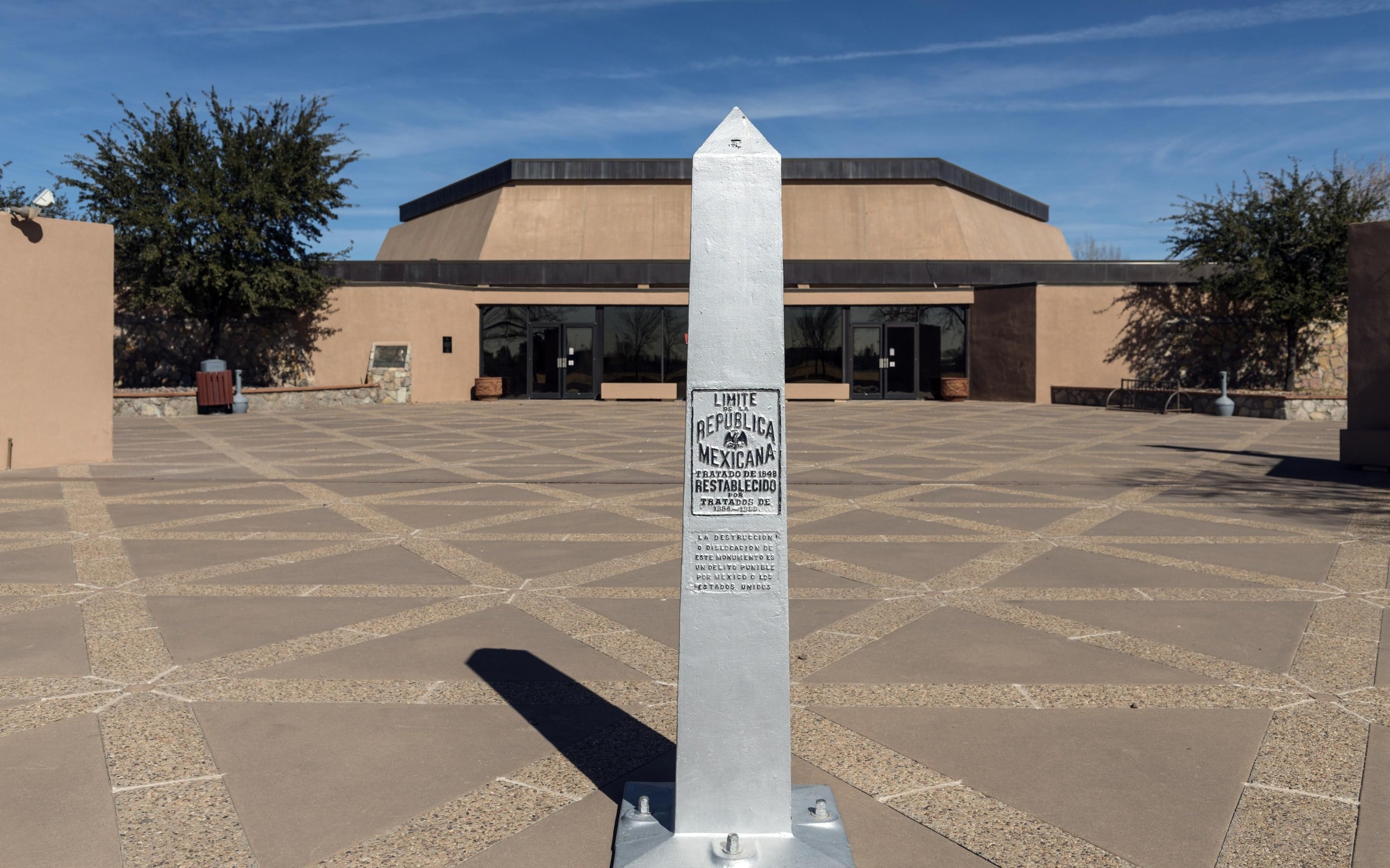
Stone boundary marker obelisk in front of the Chamizal National Memorial building in El Paso, Texas
Carol M. Highsmith / Library of Congress (via Wikimedia Commons) · Public domainInternational boundary marker at the Chamizal National Memorial, El Paso, Texas (2014). Cropped to 16:10.
Diplomacy · North America

Chamizal: when a river moved

The river changed course. Diplomats had to change the map.

In the El Paso–Ciudad Juárez area, shifts in the Rio Grande produced a long territorial dispute. Chamizal asks a deceptively difficult question: if a boundary river moves, does the country move with it?

Open field notes

Life across the line

The settlement also displaced residents whose homes lay in the affected area. A peaceful diplomatic achievement still had profound consequences for local families.

  1. 19th century

    Changes in the Rio Grande generated territorial claims.

  2. 1963

    Mexico and the United States agreed a settlement.

  3. After the agreement

    Land transfers and channel construction implemented the solution.

Natural boundaries can require very human negotiation.

Compare United States & Mexico ↗
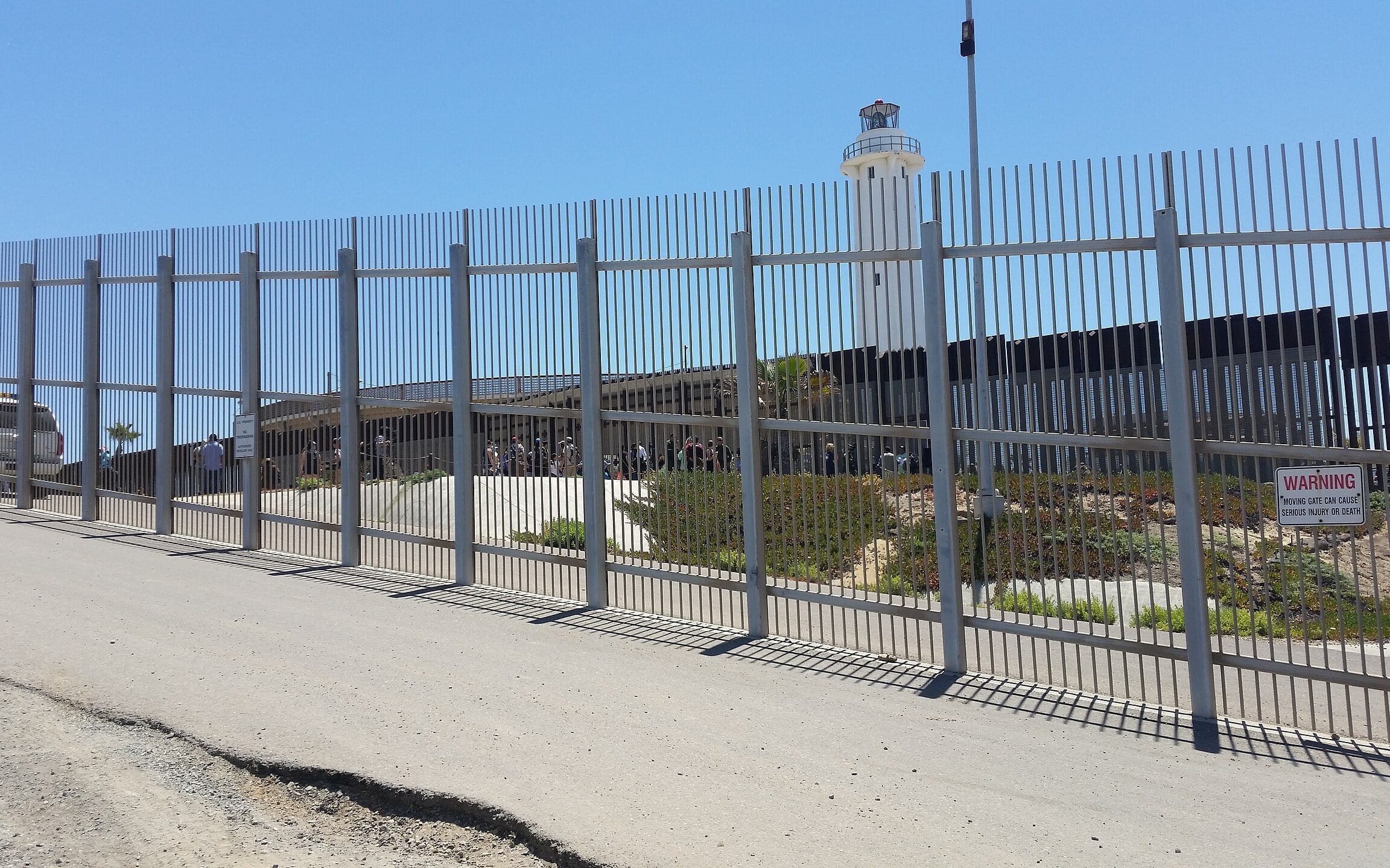
Tall border fence on Monument Mesa with Tijuana's bullring and lighthouse visible beyond
RightCowLeftCoast via Wikimedia Commons · CC BY-SA 4.0Friendship Park in Border Field State Park, San Diego, looking into Tijuana beyond the fence (April 2017). Access rules have changed since. Cropped to 16:10. This adaptation is shared under CC BY-SA 4.0.
Shared communities · North America

Friendship Park

A meeting place where the border reaches the Pacific.

At San Diego and Tijuana, Friendship Park sits where the international boundary meets the coast. Its history centres on people trying to maintain contact across a line that became increasingly difficult to approach.

Open field notes

Life across the line

For separated families, a fence is not an abstract map symbol. The park’s history shows how changes in border management can reshape the simplest human act: meeting someone face to face.

  1. 1971

    Border Field State Park was dedicated by Pat Nixon.

  2. Later decades

    Additional barriers and restrictions changed the meeting space.

  3. Historical photograph

    The displayed 2017 view is not a current access guide.

Always read an image’s date before imagining what is possible today.

Compare United States & Mexico ↗
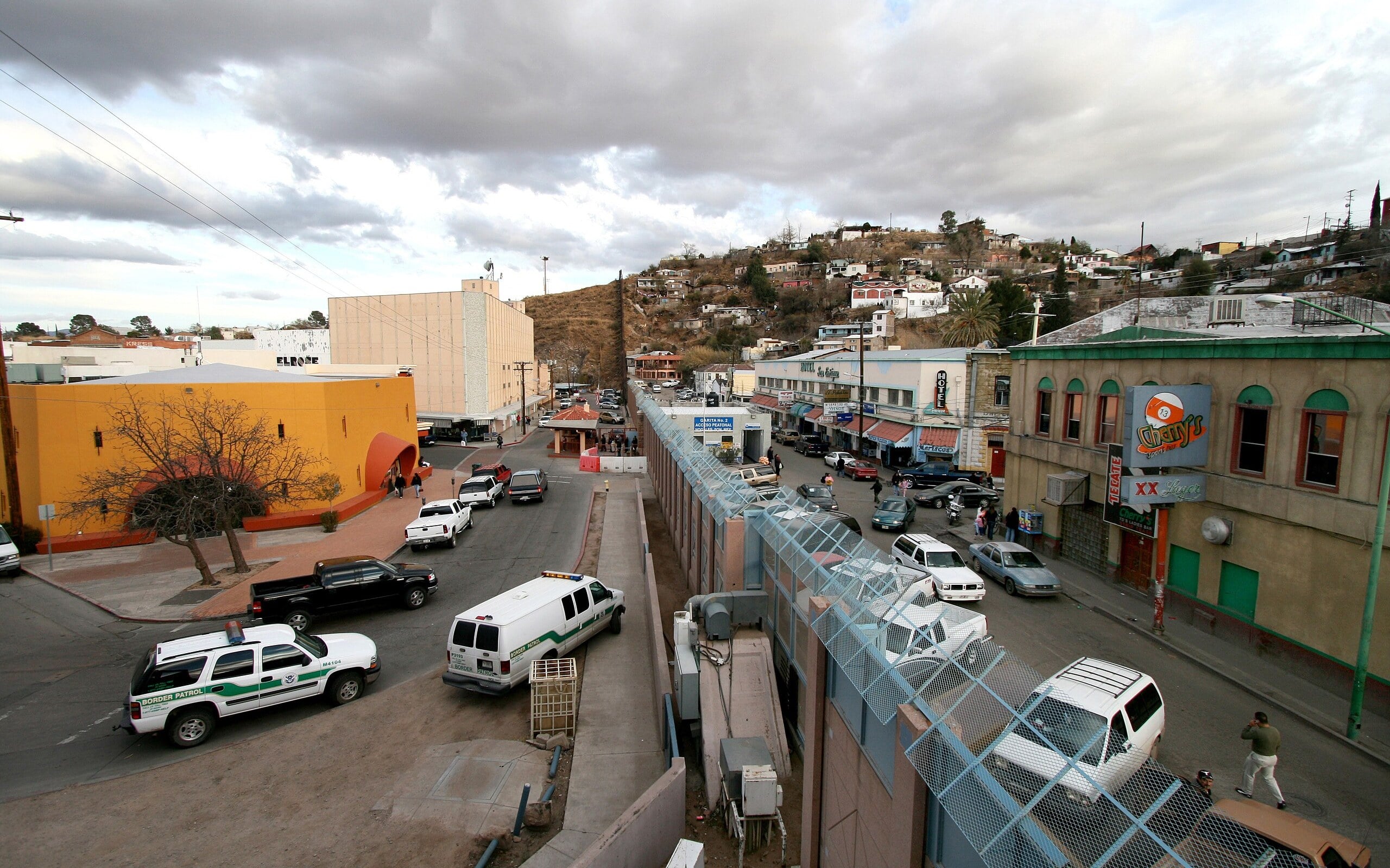
Border fence running between Nogales, Arizona, and Nogales, Sonora, with houses on the hills
Sgt. 1st Class Gordon Hyde via Wikimedia Commons · Public domainThe US–Mexico border fence dividing Nogales, Arizona (left) and Nogales, Sonora (2007). Cropped to 16:10.
Shared communities · North America

Ambos Nogales

Two cities share a name, a valley and a long commercial story.

Nogales, Arizona, and Nogales, Sonora, face each other across the United States–Mexico boundary. Often called Ambos Nogales—both Nogales—they grew around a north–south route rather than around two unrelated town centres.

Open field notes

Life across the line

Cross-border commerce connects businesses and households, while inspections and barriers influence daily schedules. A shared town name does not mean shared immigration rules.

  1. 1854

    The Gadsden Purchase reshaped the regional boundary.

  2. 1882

    Rail connections helped the settlement develop.

  3. Today

    Ambos Nogales remains a paired border-city region.

Borders can divide an urban landscape while linking its economy.

Compare United States & Mexico ↗
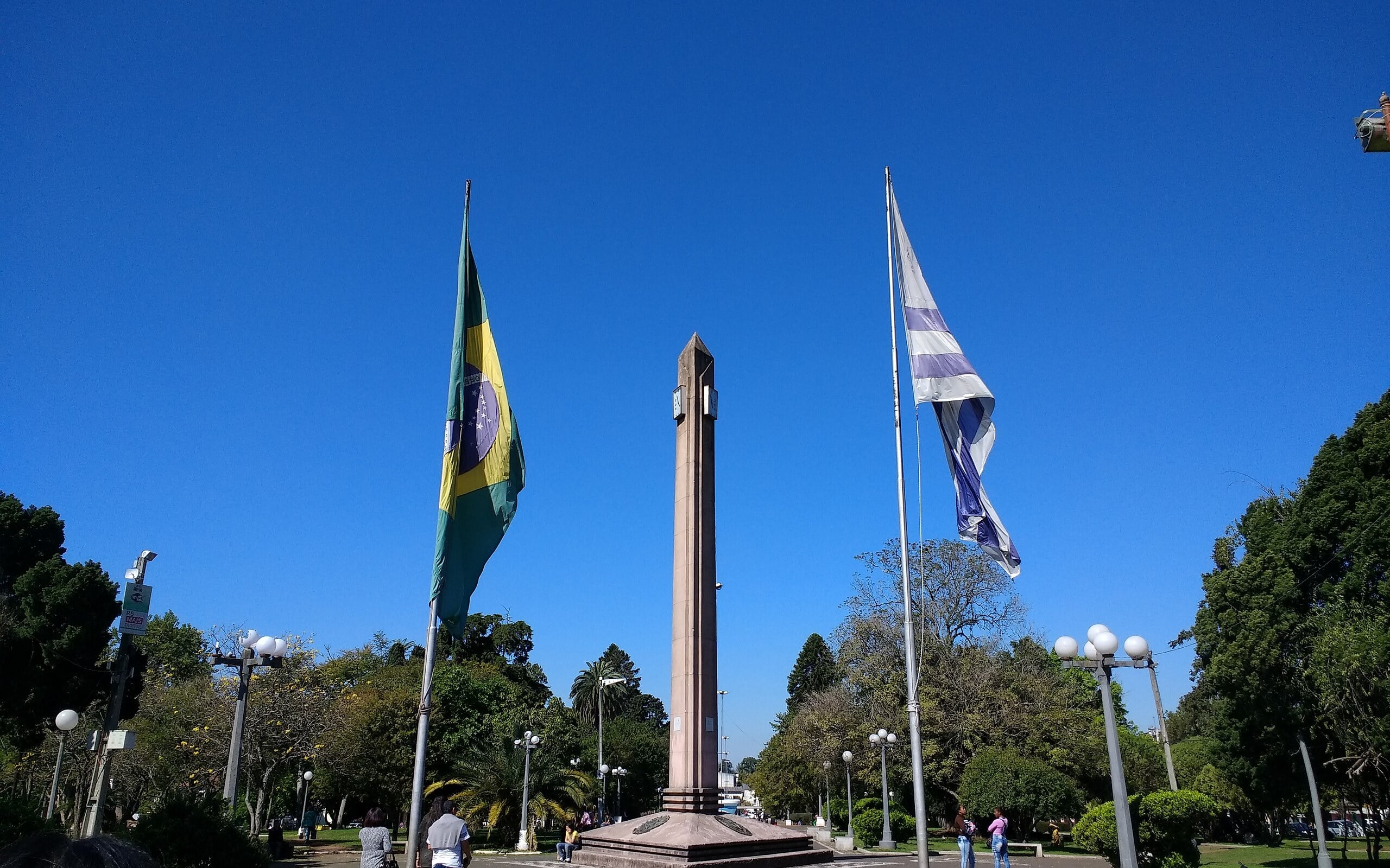
Obelisk in the International Square flanked by flags of Brazil and Uruguay
Mx. Granger via Wikimedia Commons · CC0Plaza Internacional on the line between Rivera, Uruguay, and Santana do Livramento, Brazil (2017). Cropped to 16:10.
Shared communities · South America

Rivera & Santana do Livramento

An international boundary through an everyday city square.

Rivera in Uruguay and Santana do Livramento in Brazil form a continuous urban area. Their dry border has no river canyon separating the towns; the International Park is a shared landmark along the line.

Open field notes

Life across the line

Shopping, work and family networks cross the frontier. Portuguese and Spanish meet in everyday conversation, while prices and currency differences influence local trade.

  1. Border formation

    Regional rivalries shaped the Brazil–Uruguay frontier.

  2. Urban growth

    The two towns developed into an adjoining urban area.

  3. Today

    Public spaces and commerce connect the neighbouring municipalities.

An international border can be central to a city’s identity rather than its outer edge.

Compare Uruguay & Brazil ↗
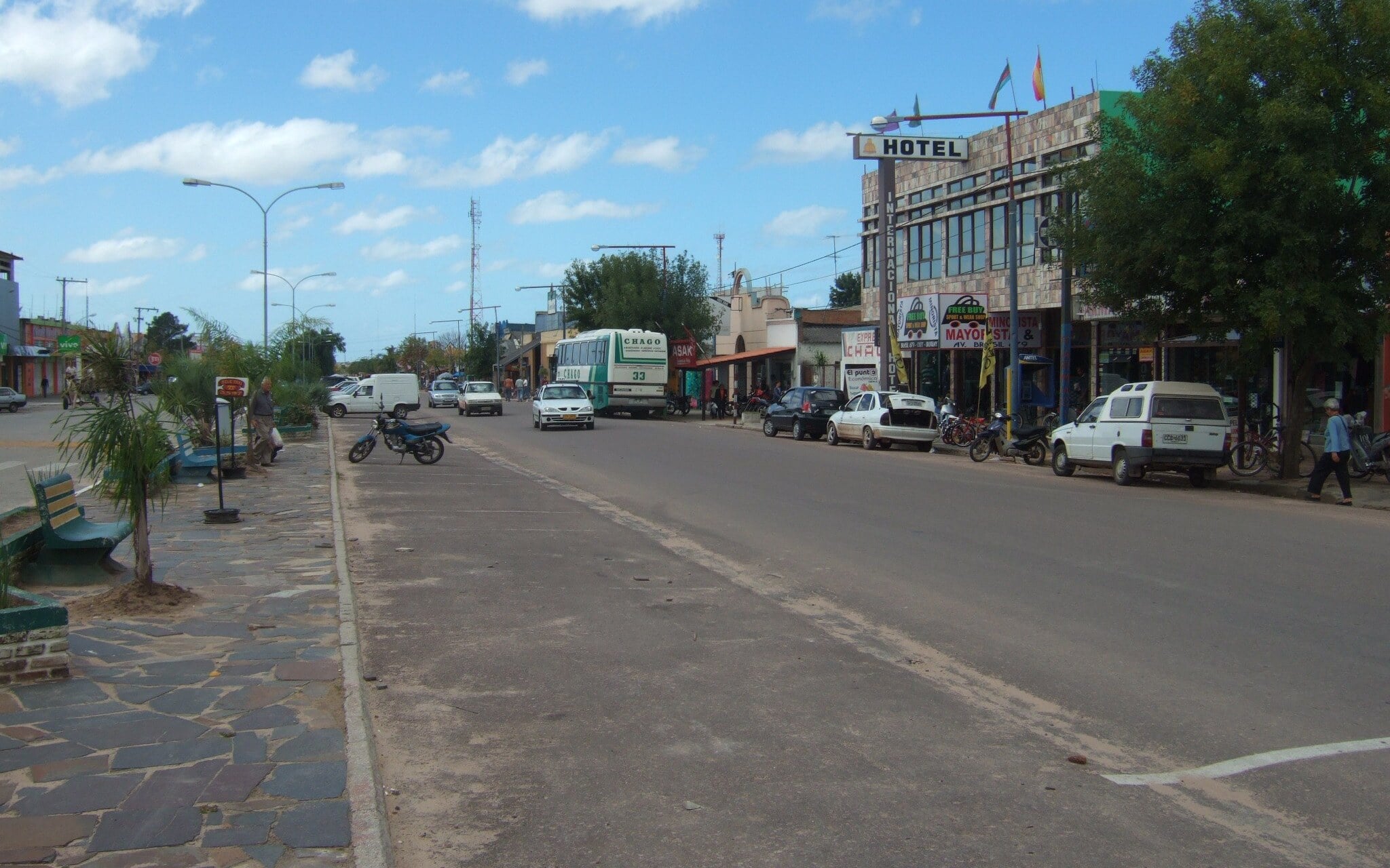
Busy shopping avenue in Chuy whose median is the Uruguay–Brazil border
John Seb Barber via Wikimedia Commons · CC BY 2.0Avenida Brasil/Uruguay in Chuy, the street whose median marks the Uruguay–Brazil border (2008). Cropped to 16:10.
Shared communities · South America

Chuy & Chuí

Change the accent mark, cross the avenue, change the country.

Chuy in Uruguay and Chuí in Brazil sit along a dry international border. A shared avenue makes the boundary part of the shopping streets rather than a remote line outside town.

Open field notes

Life across the line

Shoppers can encounter two languages and different commercial systems within a short walk. The absence of an imposing barrier does not exempt onward travellers from formal entry requirements.

  1. Boundary formation

    The regional frontier became an international dividing line.

  2. Town development

    Neighbouring commercial streets grew on both sides.

  3. Today

    The avenue remains a defining feature of the twin towns.

Not every frontier needs a wall, river or mountain to be real.

Compare Uruguay & Brazil ↗
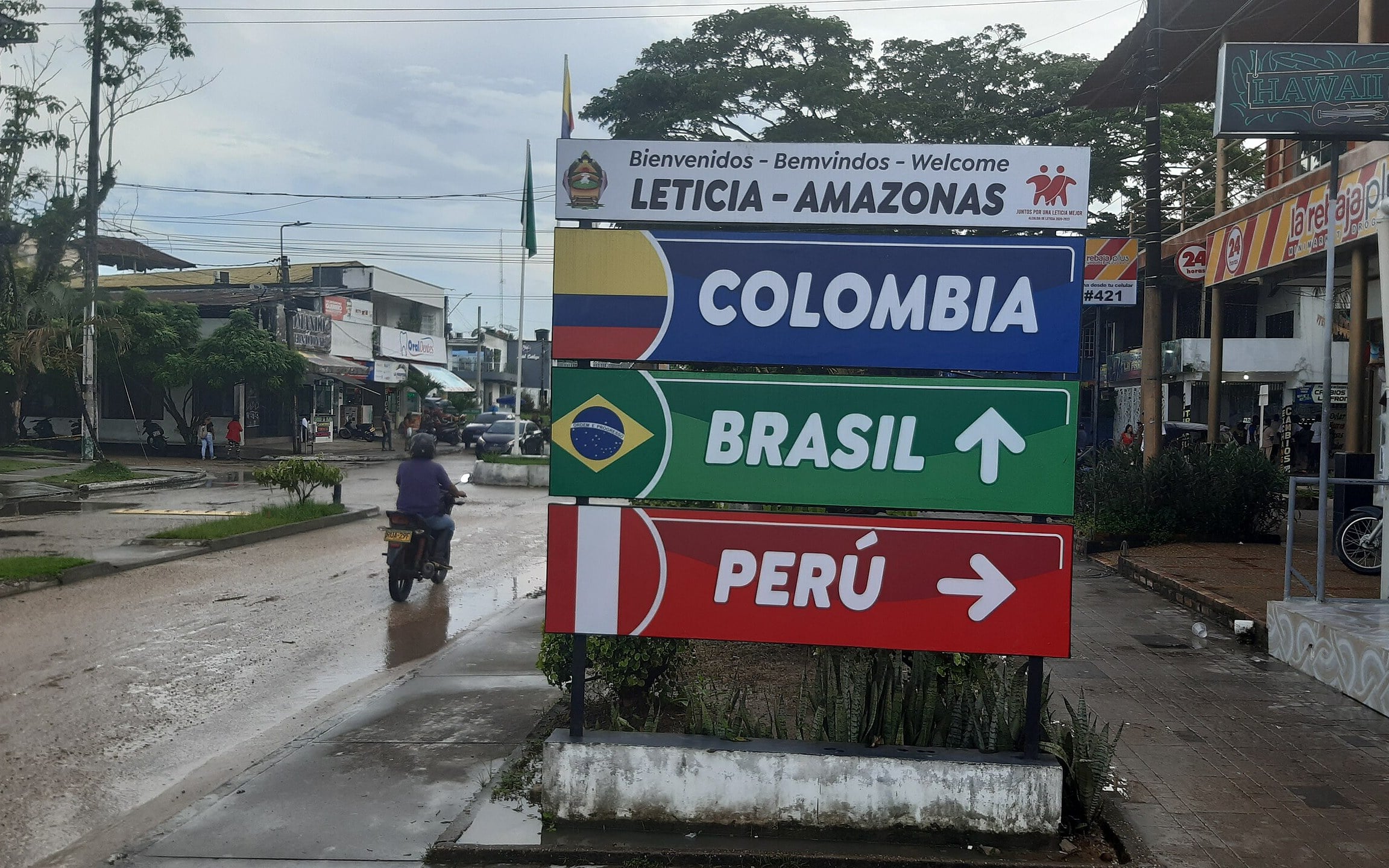
Signpost pointing to Leticia, Colombia, Brazil and Peru at the urban border
Ridiculopathy via Wikimedia Commons · CC0Signpost at the Leticia (Colombia)–Tabatinga (Brazil) border, also pointing to Peru (2024). Cropped to 16:10.
Shared communities · South America

Leticia & Tabatinga

Two adjoining towns—and a third country across the Amazon.

Leticia in Colombia and Tabatinga in Brazil form an adjoining urban area on the Amazon. Nearby Peruvian territory completes the region known as Tres Fronteras, or Three Borders.

Open field notes

Life across the line

River transport, markets and multilingual encounters link daily life. Indigenous connections in the region long predate the modern national labels shown on a map.

  1. Before modern borders

    Indigenous communities maintained connections through the Amazon basin.

  2. National frontier era

    Colombian, Brazilian and Peruvian jurisdictions developed around the river.

  3. Today

    Leticia and Tabatinga form a closely linked urban frontier.

A river may be a border on paper and the main connecting route in everyday life.

Compare Colombia & Brazil ↗
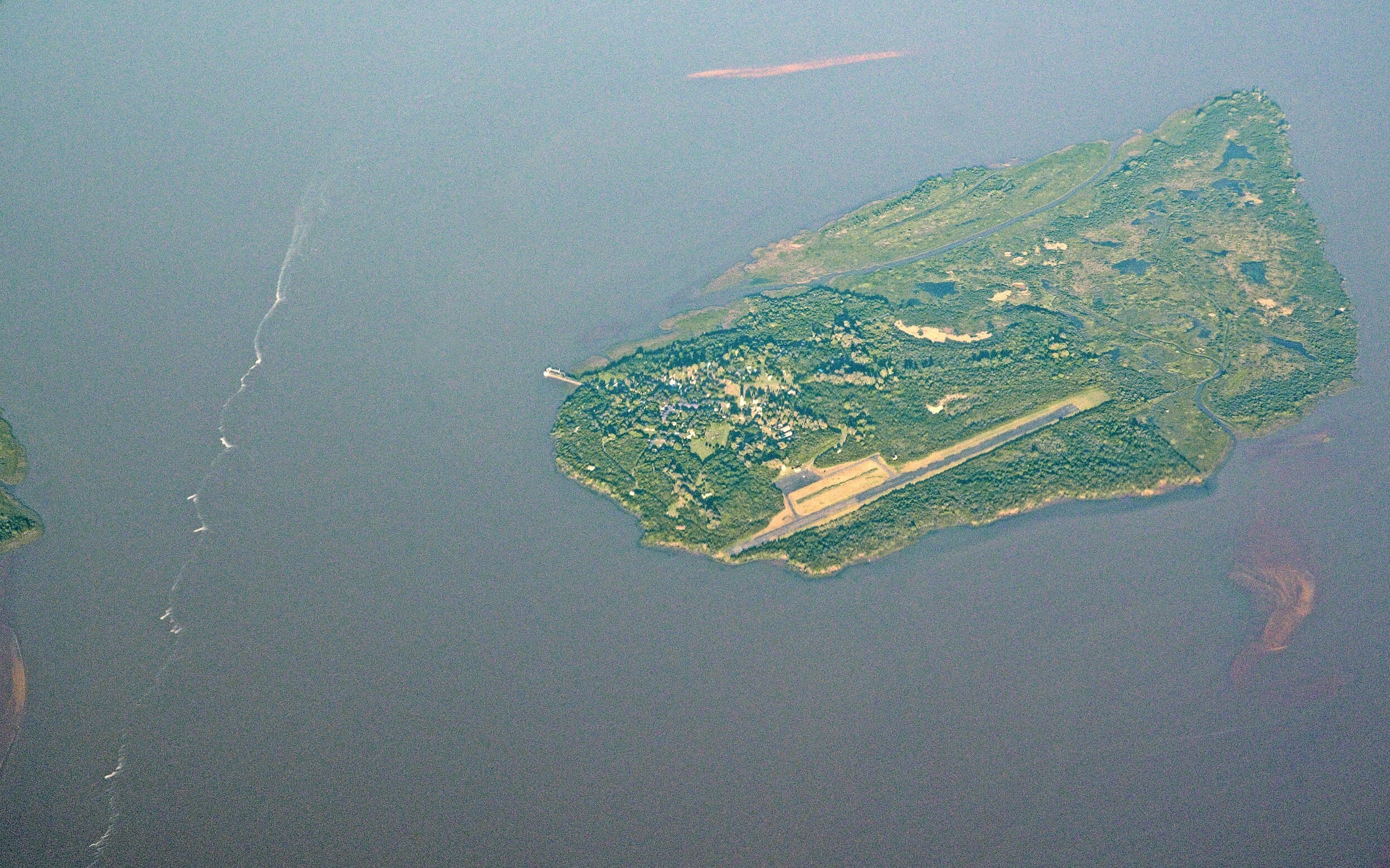
Aerial view of Martín García Island with its airstrip, joined to Uruguay's Timoteo Domínguez Island in the Río de la Plata
Rik Schuiling / TropCrop-TCS via Wikimedia Commons · CC BY-SA 4.0Aerial view of Argentina's Martín García Island (left), now joined by sediment to Uruguay's Timoteo Domínguez Island (right), Nov 2019. Cropped to 16:10. This adaptation is shared under CC BY-SA 4.0.
Water & time · South America

Martín García & Timoteo Domínguez

Two islands grew together—but their countries did not.

Argentine Martín García and Uruguayan Timoteo Domínguez became joined by sediment accumulation in the Río de la Plata. The resulting landmass contains a land boundary between the two countries.

Open field notes

Life across the line

Conservation and boundary management must deal with a landscape that keeps changing. The legal identity of the island cannot be inferred simply from the nearest shore.

  1. 1973

    The Río de la Plata treaty set out the islands’ legal framework.

  2. Natural accretion

    Sediment joined Martín García to Timoteo Domínguez.

  3. 2019

    Authorities discussed demarcation and coordinated development of the area.

Land can grow across a gap without sovereignty growing with it.

Compare Argentina & Uruguay ↗
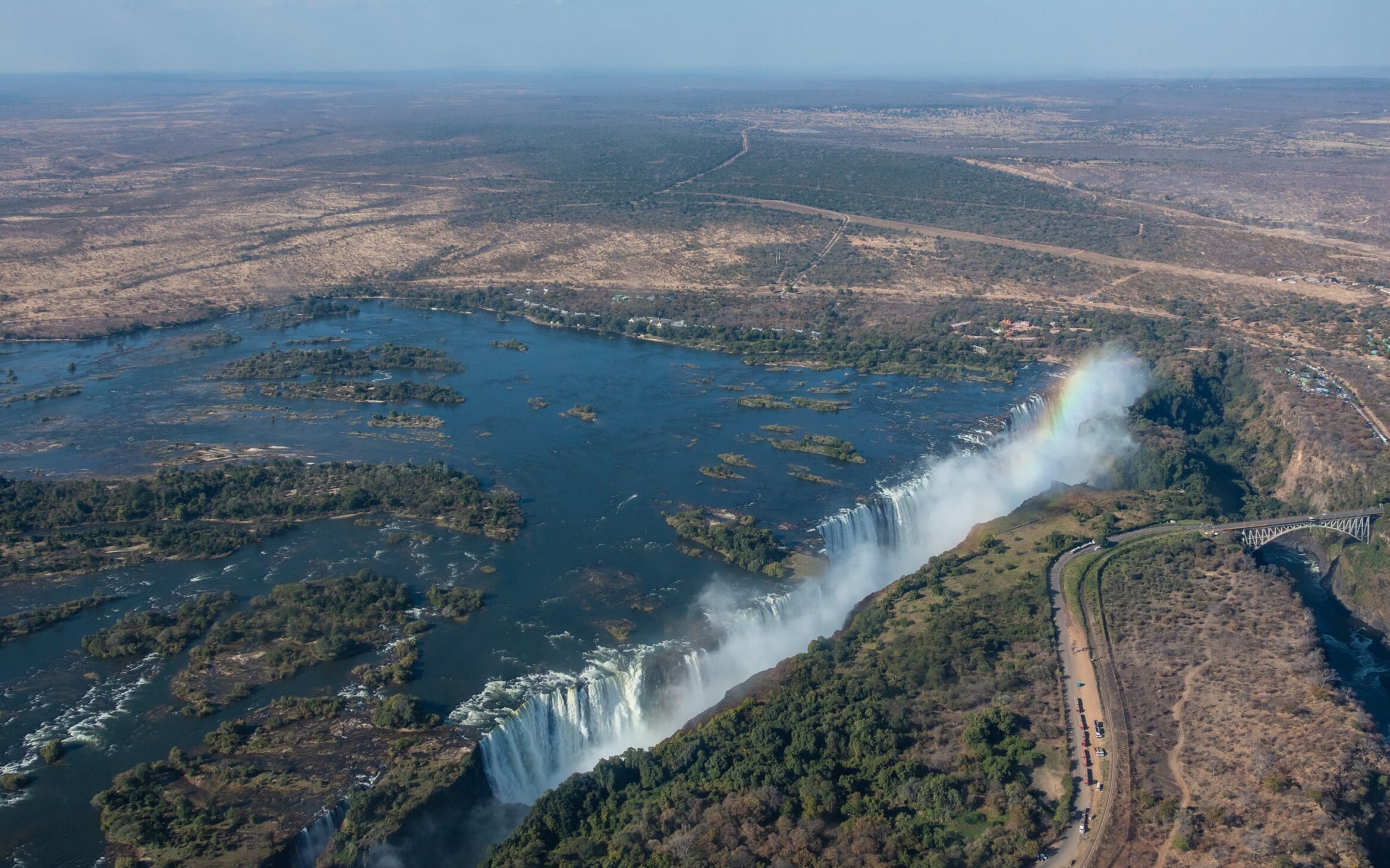
Aerial view of Victoria Falls plunging into its gorge between Zambia and Zimbabwe
Diego Delso via Wikimedia Commons · CC BY-SA 4.0Aerial view of Victoria Falls on the Zambezi, the Zambia–Zimbabwe border (2018). Cropped to 16:10. This adaptation is shared under CC BY-SA 4.0.
River crossings · Africa

Mosi-oa-Tunya / Victoria Falls

One waterfall, two countries, one shared conservation challenge.

The Zambezi plunges into basalt gorges on the Zambia–Zimbabwe frontier. Known as Mosi-oa-Tunya and Victoria Falls, this is a natural landscape whose river, spray and ecosystems cross an administrative division.

Open field notes

Life across the line

Tourism supports communities on both banks, but water levels and viewing conditions vary with the seasons. The river connects ecology, livelihoods and visitor routes while remaining an international boundary.

  1. Geological history

    The Zambezi cut a sequence of gorges through basalt.

  2. 1989

    The joint property entered the World Heritage List.

  3. Today

    Zambia and Zimbabwe share responsibility for the site.

Protecting a shared wonder requires looking beyond either bank.

Compare Zambia & Zimbabwe ↗
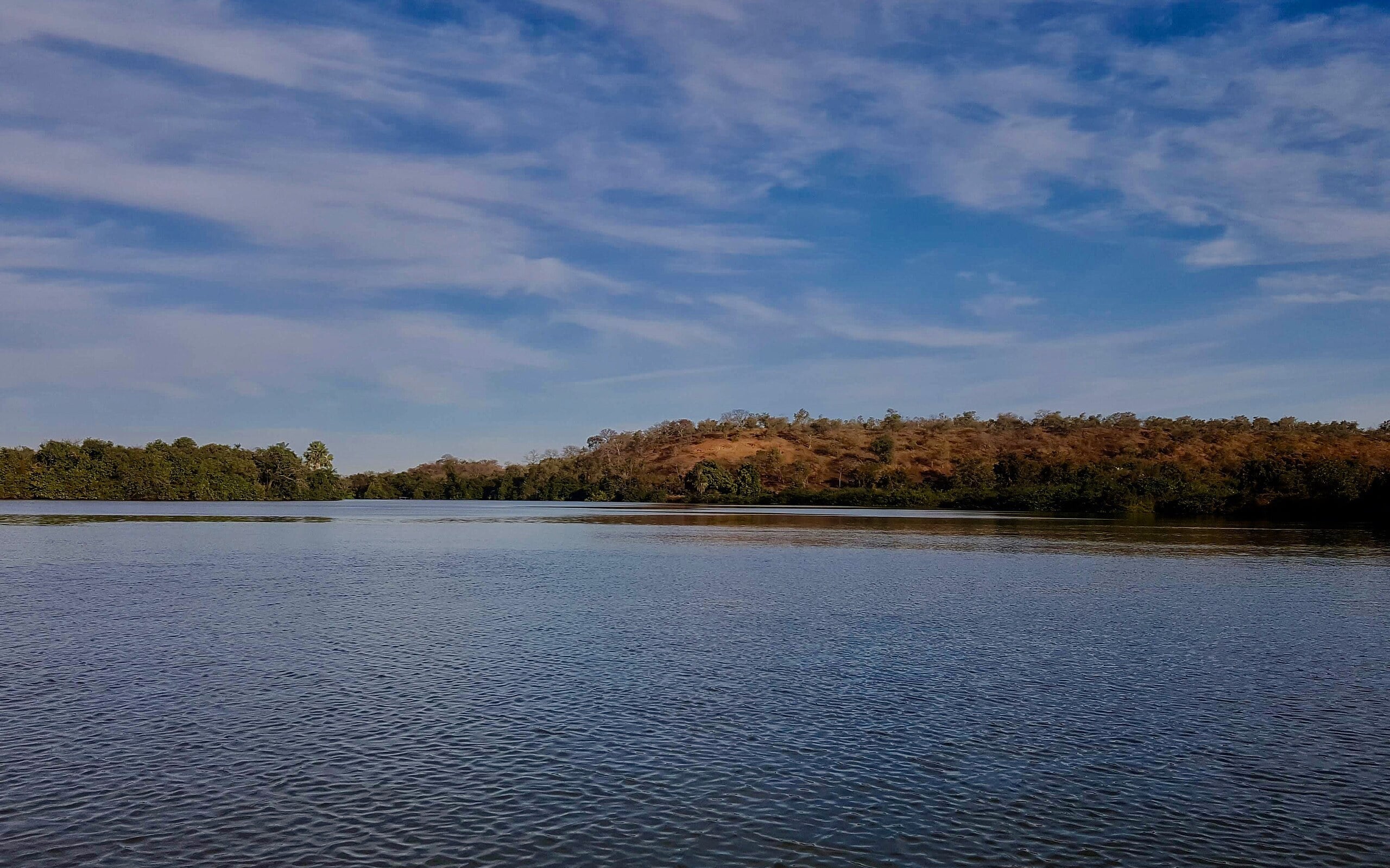
Broad Gambia River lined with mangroves and forest under a hazy sky
Wmtribe2015 via Wikimedia Commons · CC BY-SA 4.0The Gambia River upstream of Janjanbureh, The Gambia (January 2019). Cropped to 16:10. This adaptation is shared under CC BY-SA 4.0.
Border shapes · Africa

The Gambia: a country along a river

A narrow country that follows the river instead of enclosing a region.

The Gambia extends inland along the Gambia River, with Senegal surrounding its land borders and the Atlantic opening to the west. It is not a complete enclave: that coastline matters.

Open field notes

Life across the line

Communities and routes connect across the Senegal–Gambia border, while the river is central to transport, farming and settlement inside The Gambia.

  1. Colonial period

    British and French spheres developed around the river and surrounding land.

  2. 1889

    An Anglo-French convention formalised the boundary.

  3. Modern geography

    The river-centred shape persists in independent The Gambia.

A country can be almost surrounded by a neighbour without being landlocked.

Compare The Gambia & Senegal ↗
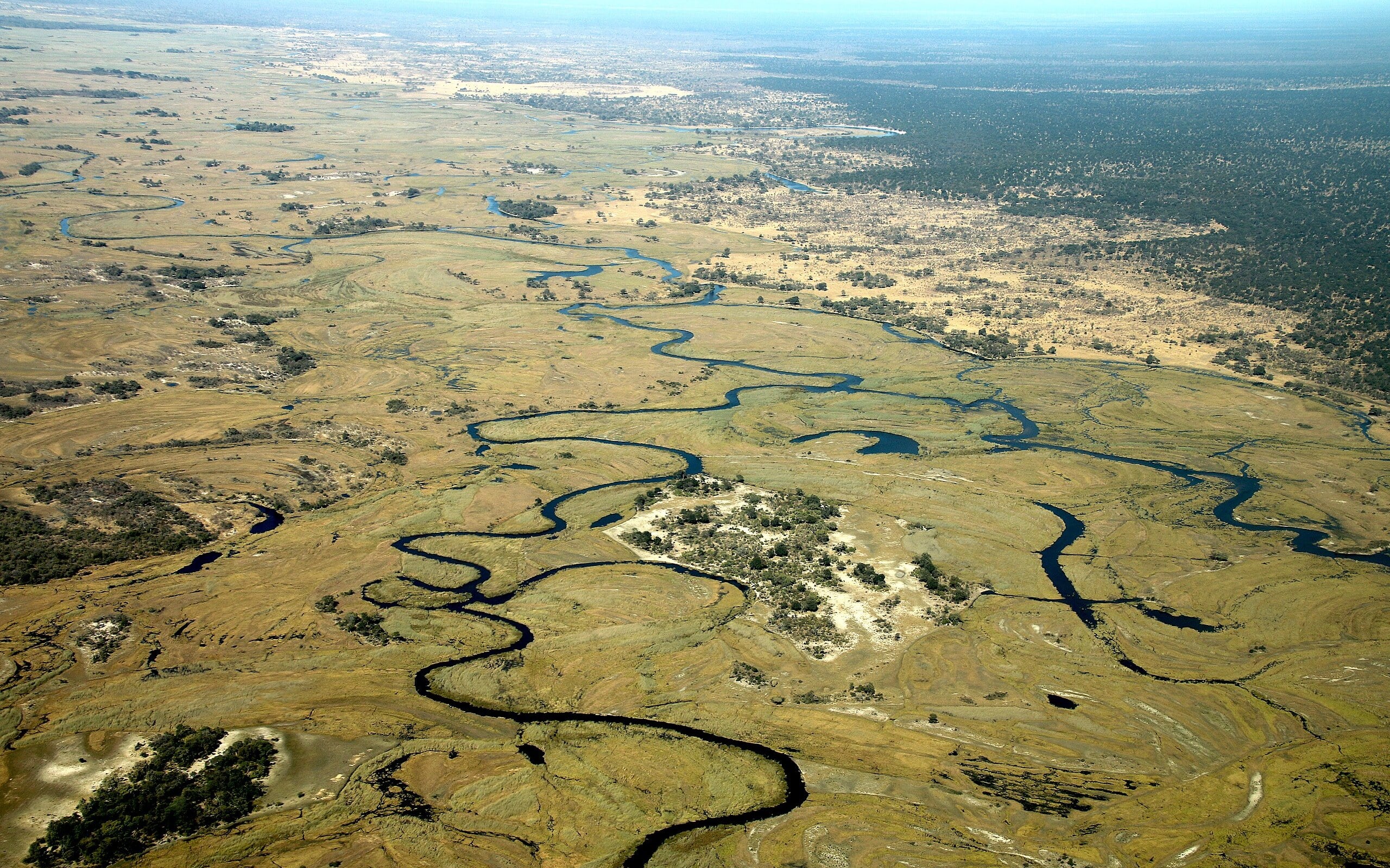
Aerial view of the meandering Kwando River and its floodplain in northeastern Namibia
Hp.Baumeler via Wikimedia Commons · CC BY-SA 4.0Aerial view of the Kwando (Cuando) River in Namibia's Zambezi Region, the eastern Caprivi Strip (2018). Cropped to 16:10. This adaptation is shared under CC BY-SA 4.0.
Border shapes · Africa

Namibia’s eastern panhandle

A narrow strip reaches into a very different river landscape.

Namibia’s eastern panhandle, historically called the Caprivi Strip, projects towards the Zambezi. It places Namibia beside several neighbours in a landscape of rivers, floodplains and wildlife routes.

Open field notes

Life across the line

Communities use river landscapes that also carry wildlife across national boundaries. A narrow corridor drawn for imperial interests now demands practical cooperation over conservation and daily movement.

  1. 1890

    An Anglo-German agreement shaped the eastern corridor.

  2. Namibian independence

    The territory remained part of Namibia.

  3. Today

    River ecosystems connect the panhandle to neighbouring countries.

A peculiar outline can outlive the political ambitions that created it.

Compare Namibia & Botswana ↗
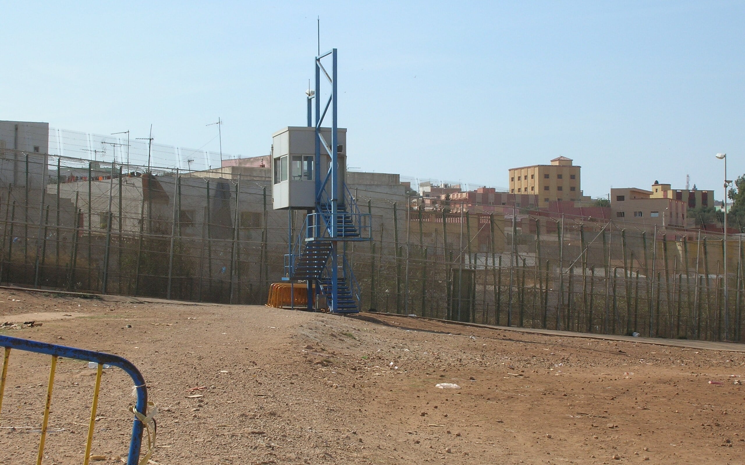
High border fence with a guard post on the edge of Melilla, Spain, facing Morocco
Acad Ronin via Wikimedia Commons · CC BY-SA 3.0The border fence between Melilla, Spain, and Morocco, with a guard post (2010). Shows Melilla, not Ceuta. Cropped to 16:10. This adaptation is shared under CC BY-SA 3.0.
Disconnected territory · Africa

Ceuta & Melilla

Spanish cities on the African mainland.

Ceuta and Melilla are Spanish-administered autonomous cities on North Africa’s Mediterranean coast. Each has a land boundary with Morocco, placing Spanish territory on a different continent from most of Spain.

Open field notes

Life across the line

Trade, family ties and migration make these frontiers much more than cartographic curiosities. Border controls have serious consequences for residents and people seeking entry.

  1. Mediterranean history

    The cities developed through successive regional power struggles.

  2. Modern status

    They are administered as Spanish autonomous cities.

  3. Continuing dispute

    Morocco contests Spanish sovereignty over both cities.

Geographical location, administration and sovereignty claims must be described separately.

Compare Spain & Morocco ↗
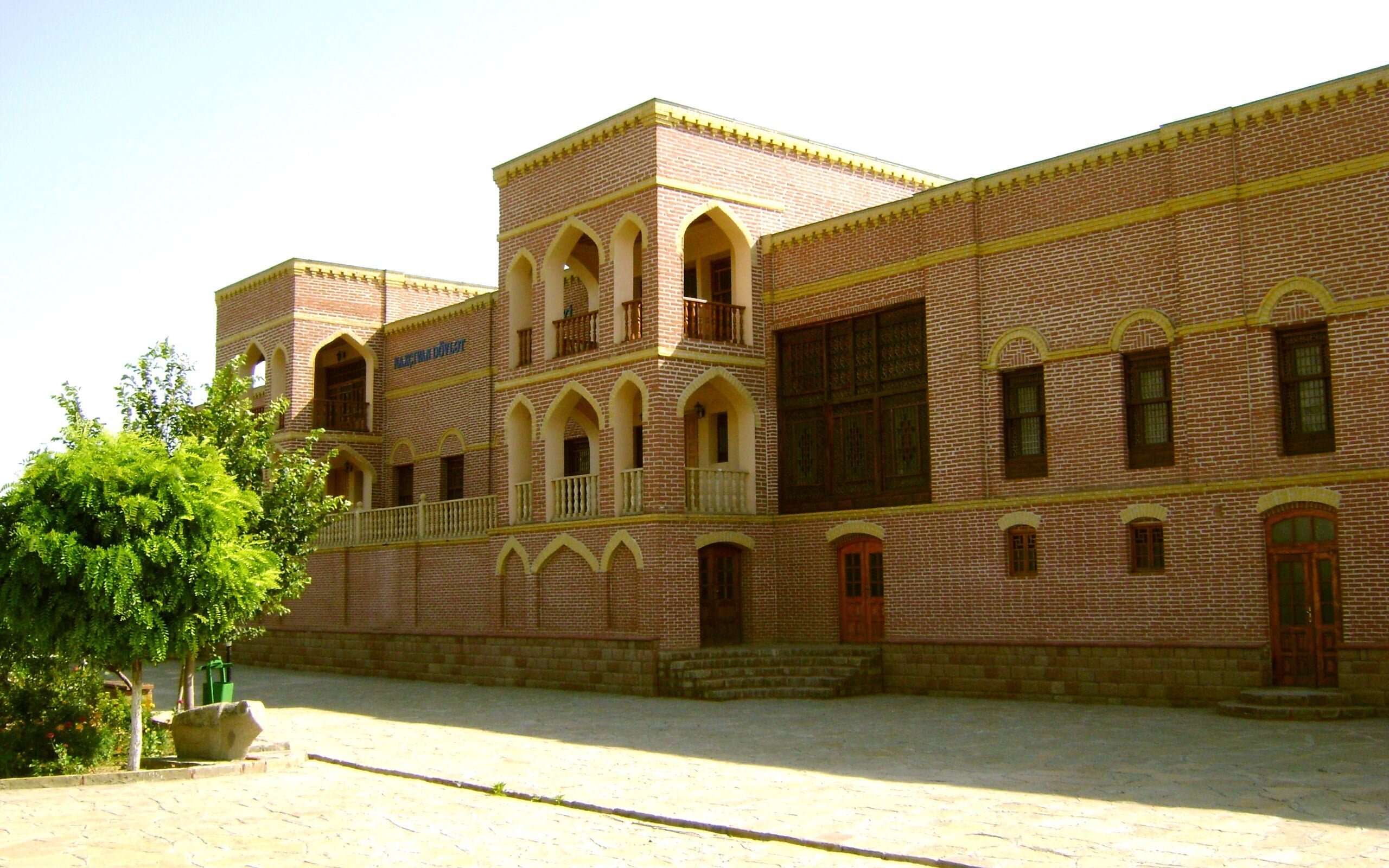
Restored Khan's Palace with arched facade in Nakhchivan city, Azerbaijan
Самый древний via Wikimedia Commons · Public domainThe Khan's Palace in Nakhchivan city, capital of Azerbaijan's Nakhchivan exclave (2009). Cropped to 16:10.
Disconnected territory · Asia

Nakhchivan

Part of Azerbaijan, separated from its main territory.

Nakhchivan is an autonomous republic of Azerbaijan, geographically separated from the rest of the country by Armenia. It borders Armenia, Iran and Türkiye, making it an exclave rather than an enclave inside just one state.

Open field notes

Life across the line

For an exclave, access routes affect trade, family travel and supplies. A line linking it to the parent country on a diagram says nothing about the legal or practical availability of a route.

  1. 1924

    Nakhchivan became an autonomous republic within Soviet Azerbaijan.

  2. 1991

    It remained part of Azerbaijan as the country became independent.

  3. Today

    Its detached geography continues to shape transport questions.

An exclave need not be surrounded by a single neighbour.

Compare Azerbaijan & Armenia ↗
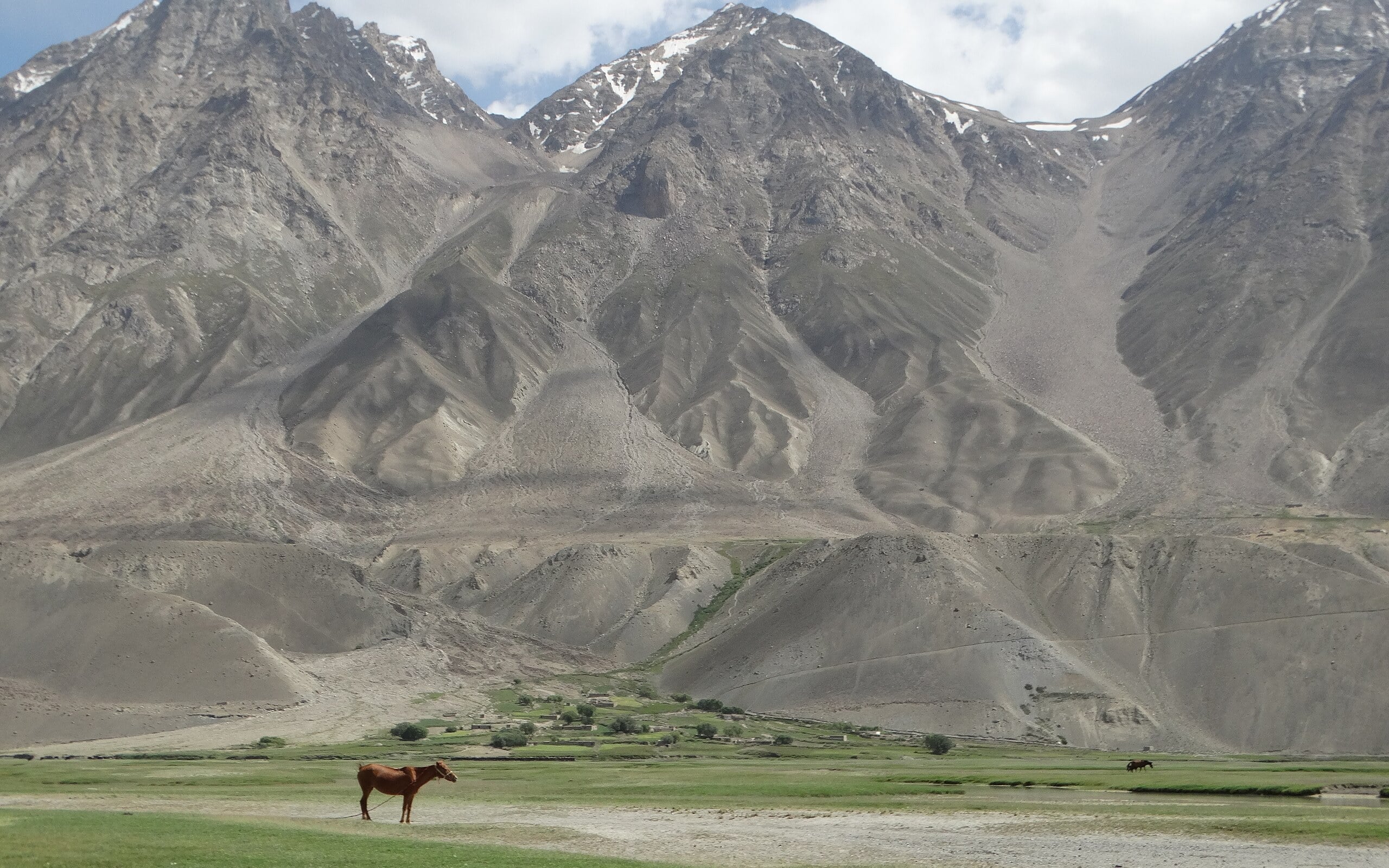
A horse grazing on a dry valley floor beneath the Hindu Kush foothills in the Wakhan Corridor
Benoît Vicart via Wikimedia Commons · CC0A horse in Afghanistan's Wakhan Corridor below the Hindu Kush (2019). Cropped to 16:10.
Border shapes · Asia

The Wakhan Corridor

A finger of Afghanistan created to keep empires apart.

The Wakhan Corridor stretches eastward through high mountains, giving Afghanistan a boundary with China while separating Tajikistan from Pakistan. Its shape is a legacy of imperial buffer-making.

Open field notes

Life across the line

Wakhi and Kyrgyz communities have lived with a landscape of seasonal pastures and demanding mountain routes. Their lives are not explained solely by the diplomatic purpose assigned to the strip.

  1. 1893

    The Durand Line agreement formed part of the regional boundary-making process.

  2. 1895

    Pamir boundary negotiations helped define the buffer arrangement.

  3. Today

    The corridor still reaches China through high mountain terrain.

What looks like empty buffer space on a map is somebody’s home.

Compare Afghanistan & Tajikistan ↗
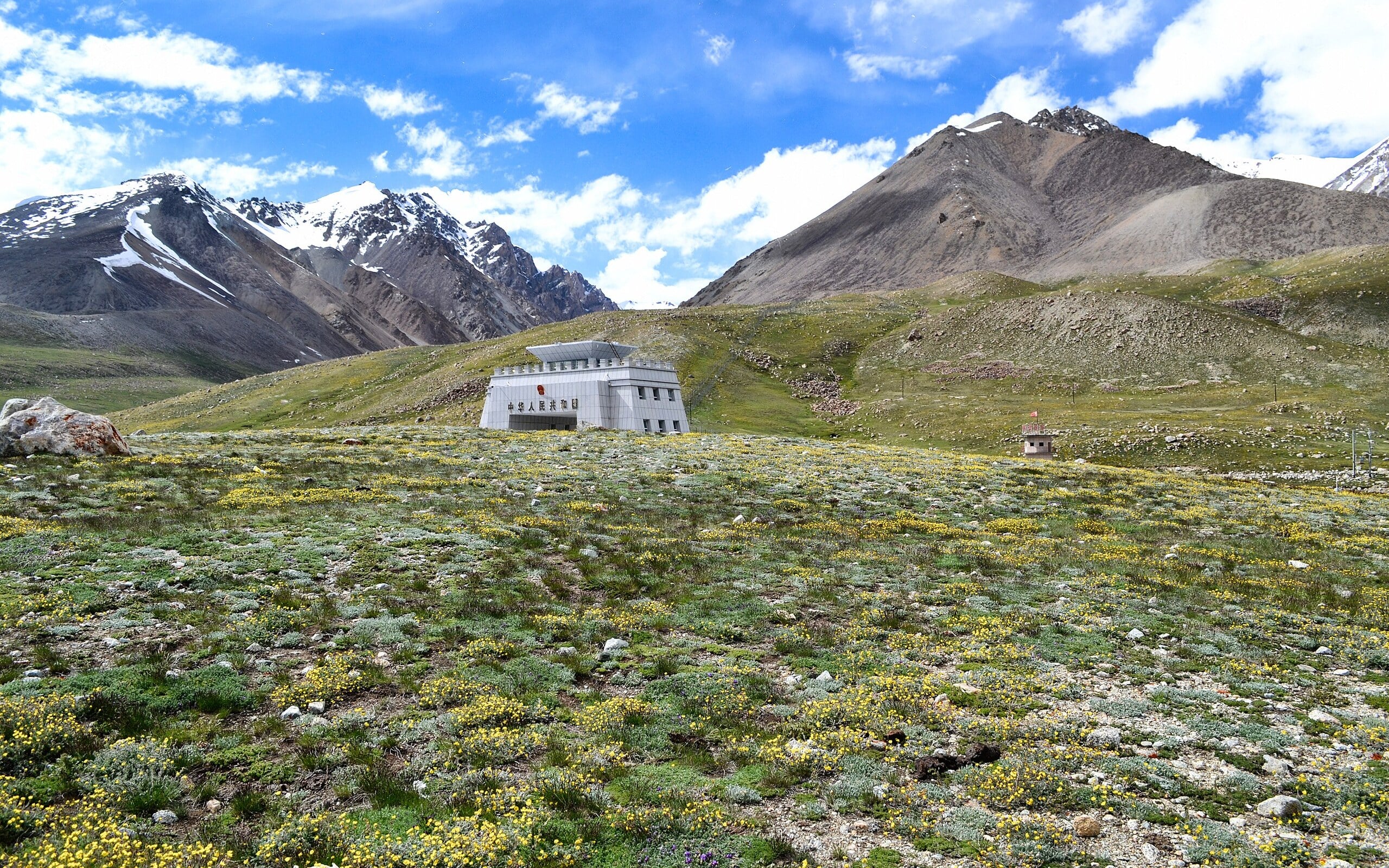
The China–Pakistan border gate building at Khunjerab Pass among snowy Karakoram peaks
Sheikh Danish Ejaz via Wikimedia Commons · CC BY-SA 4.0The border gate at Khunjerab Pass on the Karakoram Highway, China–Pakistan (2016). Cropped to 16:10. This adaptation is shared under CC BY-SA 4.0.
Mountain crossings · Asia

Khunjerab Pass

A highway frontier where mountain weather remains in charge.

Khunjerab Pass carries the Karakoram Highway between China’s Xinjiang and Pakistan-administered Gilgit-Baltistan. The road is a major engineering connection across very high mountain terrain.

Open field notes

Life across the line

Freight, travellers and border staff face demanding altitude and weather conditions. A road connection does not guarantee unrestricted or continuously available passage.

  1. 1966–1978

    Major construction work created the highway connection.

  2. 1978

    A completion ceremony marked the highway project.

  3. Today

    The high-altitude crossing remains important to regional transport.

Engineering can cross mountains, but it cannot make their constraints disappear.

Compare Pakistan & China ↗
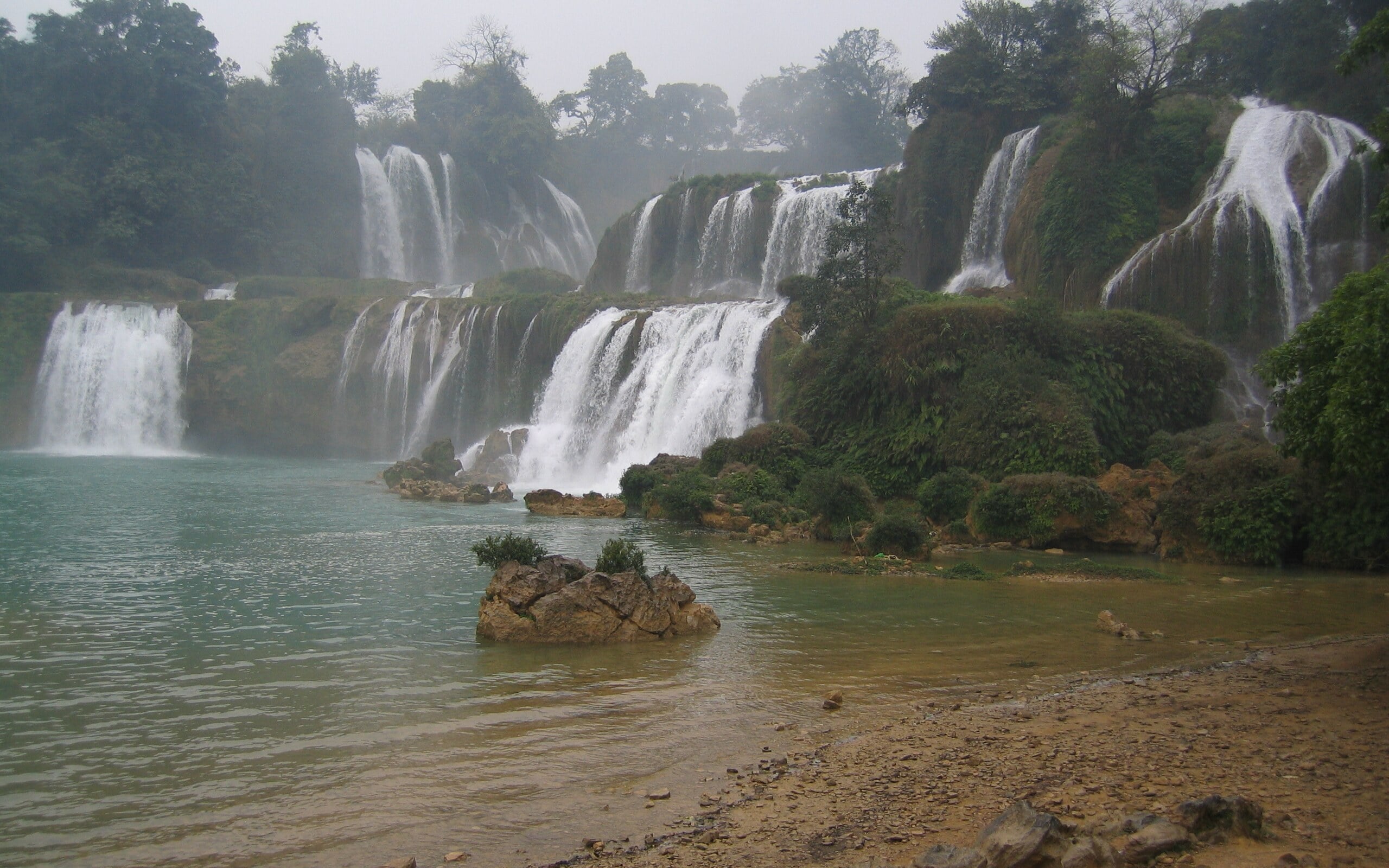
Multi-tiered Ban Gioc–Detian waterfalls framed by green karst hills
kenner116 via Wikimedia Commons · CC BY 2.0Ban Gioc–Detian Falls on the Quây Sơn River, Vietnam–China border (2011). Cropped to 16:10.
River crossings · Asia

Bản Giốc–Detian Falls

A waterfall landscape with two names and two jurisdictions.

The Bản Giốc–Detian waterfall system lies on the Quây Sơn, or Guichun, River between Vietnam and China. Karst hills and stepped cascades make the frontier a spectacular geological setting.

Open field notes

Life across the line

Local livelihoods combine farming, services and visitors drawn to the same water from different national approaches. Monsoon flow changes the appearance of the cascades.

  1. 1999

    Vietnam and China signed a land-border treaty.

  2. 2009

    Further demarcation arrangements clarified the frontier.

  3. Modern tourism

    The two sides developed cooperation around the scenic area.

A shared natural feature does not imply a single tourism or immigration system.

Compare Vietnam & China ↗
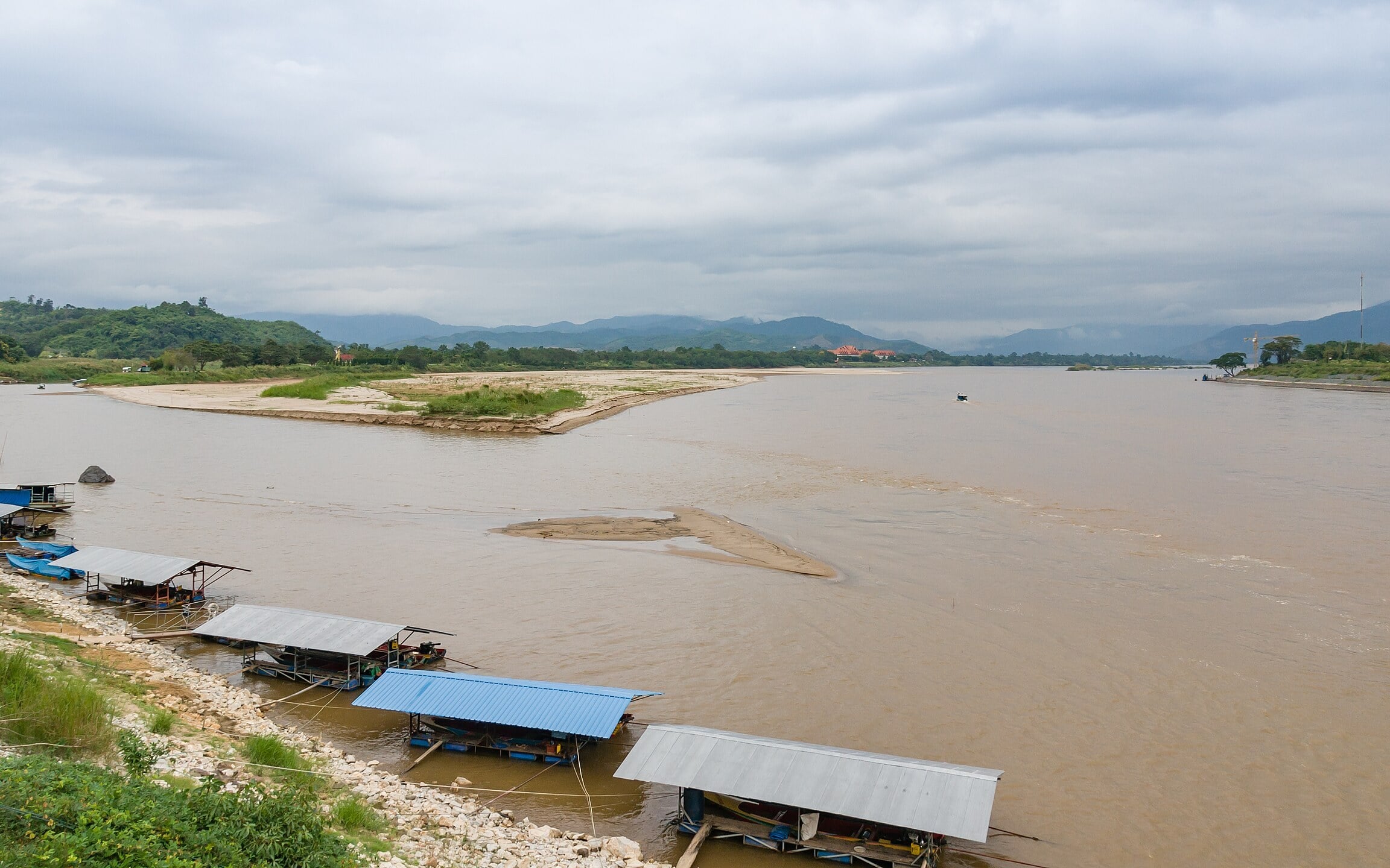
Confluence of the Ruak and Mekong rivers at Sop Ruak with the Myanmar and Laos banks beyond
CEphoto, Uwe Aranas via Wikimedia Commons · CC BY-SA 3.0The Ruak–Mekong confluence at Sop Ruak, where Thailand, Myanmar and Laos meet, seen from Thailand (2009). Cropped to 16:10. This adaptation is shared under CC BY-SA 3.0.
River crossings · Asia

Sop Ruak: the Golden Triangle

Two rivers meet—and three countries come into view.

At Sop Ruak, the Ruak meets the Mekong near the boundaries of Thailand, Laos and Myanmar. The famous viewpoint is a specific river junction within the much wider region called the Golden Triangle.

Open field notes

Life across the line

Boats and rivers remain central to the area’s connections. Museums addressing the opium trade also show why a picturesque regional nickname can carry difficult social history.

  1. Earlier trade networks

    River routes connected settlements and regional markets.

  2. 20th century

    The wider Golden Triangle became associated with the opium trade.

  3. Today

    The confluence supports tourism and interpretation of that history.

A tripoint in water is a meeting of jurisdictions, not necessarily a place to stand.

Compare Thailand & Laos ↗
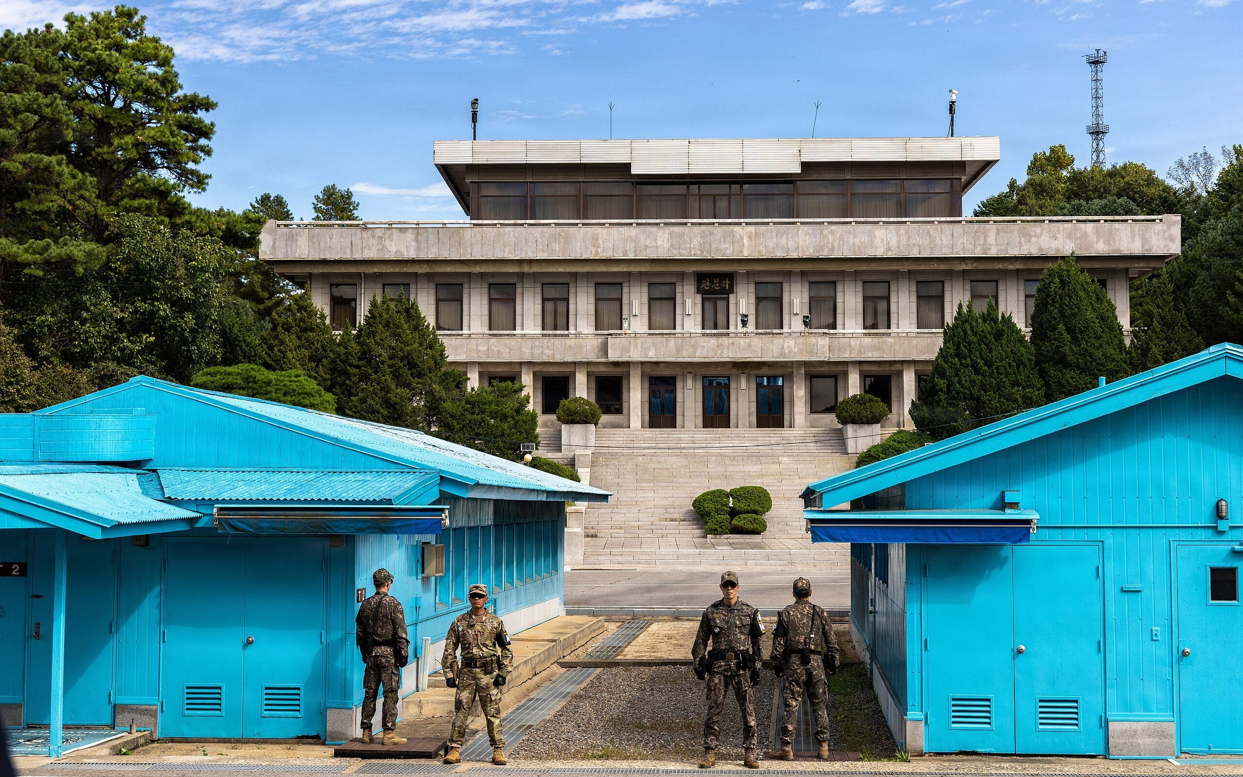
Blue conference buildings at the Joint Security Area with soldiers standing guard
U.S. Army photo by Cpl. Joseph Liggio via Wikimedia Commons · Public domainHistorical photo of the Joint Security Area, Panmunjom, during a Swedish delegation visit (October 2025). Not a claim about current access. Cropped to 16:10.
Diplomacy · Asia

Panmunjom & the Joint Security Area

A meeting place on an armistice line—not an ordinary border crossing.

The Joint Security Area near Panmunjom lies on the Military Demarcation Line between North and South Korea. Its meeting buildings became a powerful image of both confrontation and dialogue.

Open field notes

Life across the line

The line carries the consequences of war and separation. Official encounters here matter partly because ordinary movement across it is so restricted.

  1. 1951–1953

    Negotiations sought an armistice to halt the fighting.

  2. 1953

    The armistice established the military demarcation framework.

  3. Since the armistice

    The area has hosted tightly controlled military and diplomatic encounters.

Not every line separating states has the same legal history as a settled international boundary.

Compare South Korea & North Korea ↗
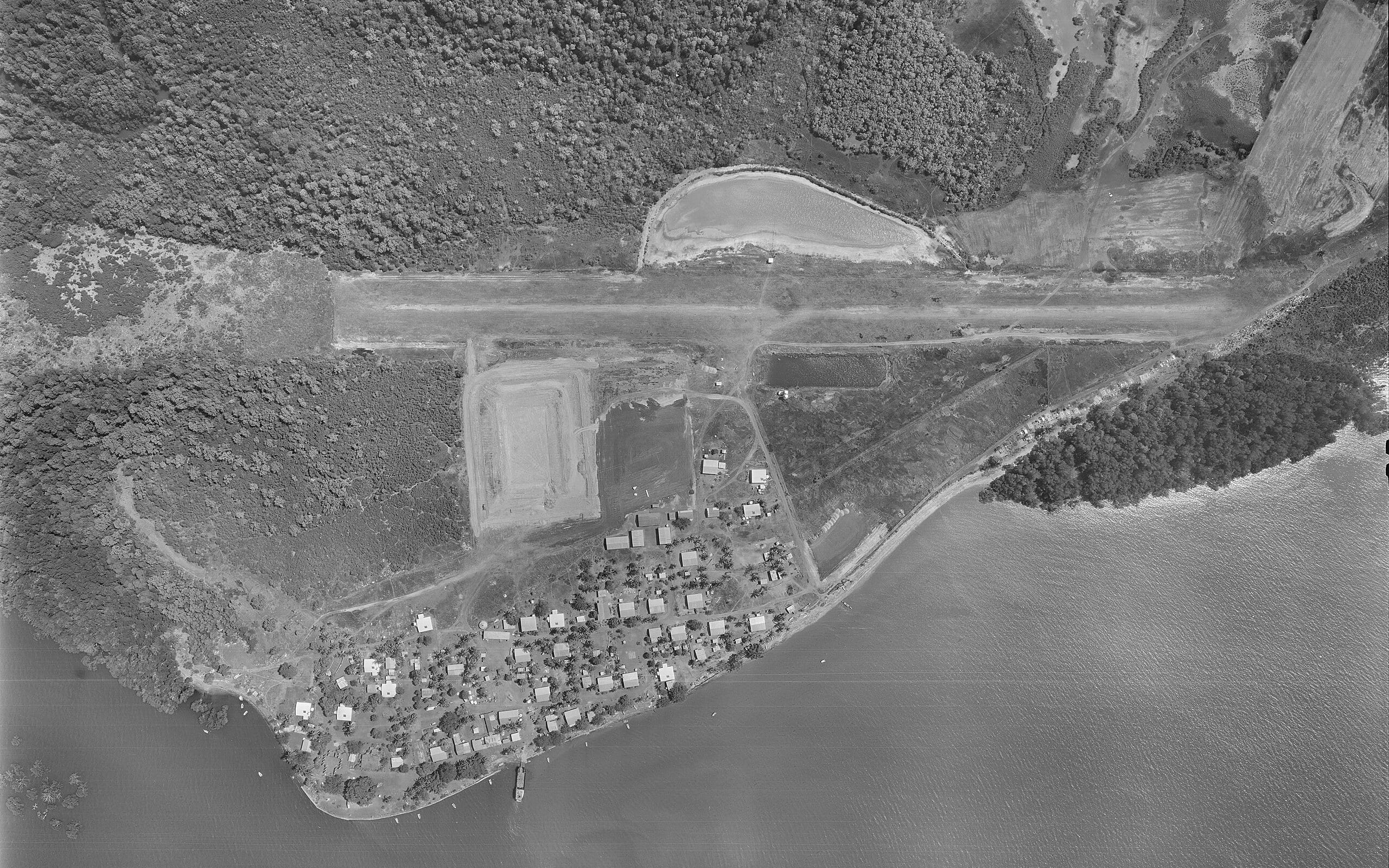
Black-and-white aerial photo of the airstrip and community on Boigu Island
Commonwealth of Australia / Qld Dept of Natural Resources and Mines (QImagery) via Wikimedia Commons · CC BY 4.0Historical aerial of Boigu Island, Torres Strait, Australia's northernmost inhabited island near PNG (1 Oct 1987, black and white). Cropped to 16:10.
Water & time · Oceania

Torres Strait: borders and traditional life

A maritime treaty designed around people—not just water.

Torres Strait separates Australia and Papua New Guinea, but some Australian islands lie very close to the New Guinea coast. The treaty framework recognises that traditional communities and activities cross the maritime division.

Open field notes

Life across the line

Family gatherings, traditional fishing and cultural activities depend on connections across the water. Community permissions, biosecurity and the treaty’s eligibility conditions remain important.

  1. 1978

    The Torres Strait Treaty was signed.

  2. 1985

    The treaty entered into force.

  3. Traditional movement

    Eligible communities use specific provisions for recognised traditional activities.

A border agreement can protect existing human connections as well as divide jurisdiction.

Compare Australia & Papua New Guinea ↗
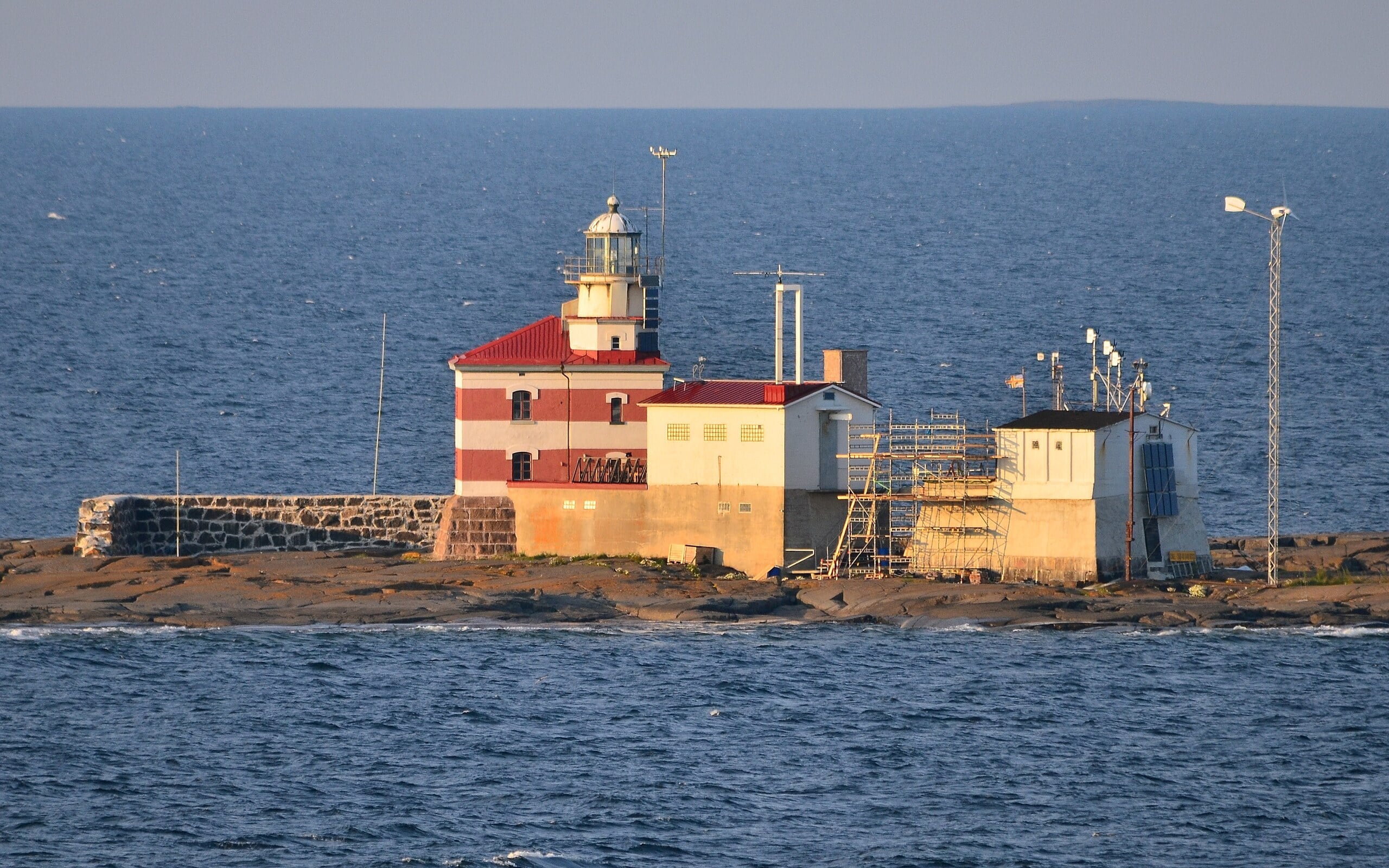
Märket lighthouse on a bare rocky islet in the Baltic Sea
Esquilo via Wikimedia Commons · CC BY-SA 3.0Märket lighthouse on the islet divided between Finland (Åland) and Sweden (2013). Resized; already 16:10. This adaptation is shared under CC BY-SA 3.0.
Diplomacy · Europe

Märket: the lighthouse border

The lighthouse stayed. The border bent around it.

Märket is a small Baltic skerry shared by Finland and Sweden. Its unusually bent boundary is connected to a Finnish lighthouse built in 1885 on what was then the Swedish side.

Open field notes

Life across the line

For lighthouse work, a safe building site mattered; for boundary-makers, area and coastal arrangements also mattered. Negotiation reconciled the two without moving the structure.

  1. 1885

    The lighthouse was built on the Swedish side of the existing line.

  2. 1985

    Finland and Sweden adjusted the boundary through a land exchange.

  3. Today

    The lighthouse stands on the Finnish part of the skerry.

Sometimes redrawing a small line is easier than moving a large building.

Compare Finland & Sweden ↗
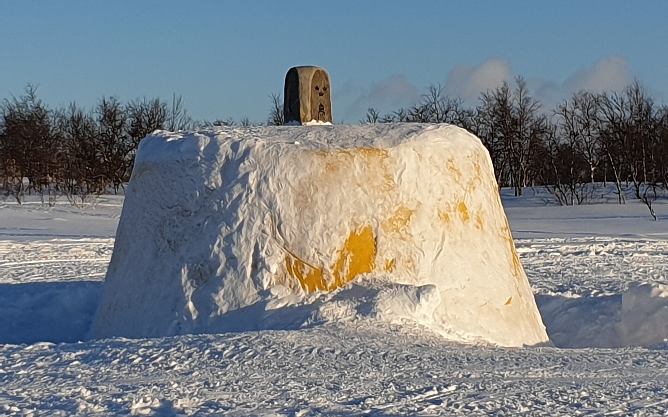
Snow-covered Three-Country Cairn standing in a frozen lake
WikiLucas00 via Wikimedia Commons · CC BY-SA 4.0Treriksröset, the cairn where Sweden, Finland and Norway meet, in winter (2020). Cropped to 16:10. This adaptation is shared under CC BY-SA 4.0.
Meeting points · Europe

The Three-Country Cairn

Three countries meet at a marker standing in a lake.

The Three-Country Cairn marks the meeting of Finland, Sweden and Norway near Lake Goldajärvi. The concrete monument is a visible marker of a tripoint rather than the summit of a mountain.

Open field notes

Life across the line

The marker sits within a wider northern landscape with Sámi connections that do not fit neatly inside three national compartments. Routes to the site and local conditions require separate practical planning.

  1. 1897

    An earlier stone marker was erected.

  2. 1926

    The present concrete monument was completed.

  3. Today

    The cairn marks the Finland–Sweden–Norway tripoint.

A tiny point can connect three national maps while overlooking a much larger cultural landscape.

Compare Finland & Sweden ↗

03 / A cartographer’s vocabulary

Not every unusual border is an enclave.

01

Enclave

Surrounded by another state.

Look at Madha: Oman, enclosed by the UAE.

02

Exclave

Separated from the main part of its own state.

Think of the German pockets beside the Vennbahn.

03

Counter-enclave

An enclave inside an enclave.

Nahwa is UAE territory inside Oman’s Madha.

04

Doubly landlocked

Surrounded only by landlocked neighbours.

Liechtenstein borders Switzerland and Austria.

Enclave and exclave describe different relationships. A place can be both. The locator map above uses generalised land outlines, not diagrams of these legal boundaries.

The passport challenge

How well do you know borders?

10 quick clues or the full 50-story challenge. No timer, no repeats within a round, and an explanation after every answer.

Try the neighbouring-countries game ↗

04 / Your next journey

A border is only the beginning.

Keep your curiosity travelling.

Enjoy the stories? Explore GeoQuest’s films and subscribe on YouTube for more geography journeys.

FAQ

Frequently asked questions

What is the difference between an enclave and an exclave?

An enclave is surrounded by another state. An exclave is separated from the main part of its own state. A territory can be both, but the words describe different relationships.

Does this map show exact international boundaries?

No. It is a small-scale locator map using generalised land outlines and approximate story locations. It does not draw legal boundary lines or express a position on sovereignty disputes.

Can I cross a border just because a story shows an open street or a shared building?

No. Geography stories are not travel permissions. Immigration rules, access restrictions and conditions can change. Consult the relevant authorities and the venue’s current guidance.

Are the former India–Bangladesh enclaves still there?

The enclaves covered by the 2015 exchange changed jurisdiction. Their former arrangement is presented here as history, not as a current border map.