Only on GeoQuest
Lines of the Earth
Drag the parallels and meridians, find the tropics and polar circles, and see exactly why they shape our seasons, climate zones and time — live on the world map.
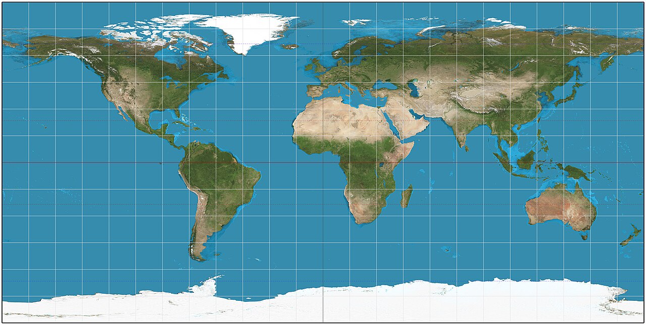
Click anywhere on the map, or drag the sliders, to move the crosshair.
- Northern Hemisphere · On the Prime Meridian
- This parallel circles the Earth in 36,769 km
- 1° of longitude here ≈ 102 km on the ground
- Local solar time ≈ UTC +0.0h
Why the tropics exist
Earth is tilted 23.4° on its axis, so through the year the point where the Sun is directly overhead — the subsolar point — slides between the two tropics. Press play to watch a full year, drag the globe to spin it, or scrub to any date.
June solstice — Sun overhead at the Tropic of Cancer (northern summer).
At the solstices the Sun reaches a tropic (its furthest overhead point); at the equinoxes it sits right on the Equator. It never passes beyond the tropics — which is exactly what defines them.
How long is the day?
Your latitude decides how your daylight changes through the year. At the Equator every day is ~12 hours; past the polar circles the Sun can stay up — or down — for months.
Dig straight through the Earth
An antipode is the point on the exact opposite side of the globe. Flip the hemisphere, shift the longitude by 180°, and see where you’d pop out. (Spoiler: it’s almost always the ocean.)
Tap a preset, or click anywhere on the map to drop your own point.
40°24′ N, 3°42′ W
Madrid, Spain
40°24′ S, 176°18′ E
off the coast of New Zealand
The three great climate zones
Tropical
0° – 23.4° latitude
Between the two tropics. The Sun can stand directly overhead; warm all year, with wet and dry seasons rather than four temperature seasons.
Temperate
23.4° – 66.6° latitude
Between the tropics and the polar circles. Four distinct seasons, the Sun never directly overhead, moderate climates where most people live.
Polar
66.6° – 90° latitude
Poleward of the polar circles. Cold all year, with months-long days and nights — the midnight sun and the polar night.
Lines that made history
Some parallels and wind-belts became borders, battle-lines and sailors’ legends.
49th parallel north
49° NThe world’s longest straight border — most of the boundary between Canada and the contiguous United States runs dead along it for ~2,000 km.
38th parallel north
38° NThe line that split Korea in 1945. The modern border zig-zags around it, but “the 38th parallel” is still shorthand for the divide.
Mason–Dixon line
≈ 39°43′ NSurveyed in the 1760s to settle a colonial dispute, it became the cultural boundary between the American North and South.
The Roaring Forties
40° – 50° SA belt of fierce, unbroken westerly winds in the Southern Ocean with almost no land to slow them — a sailor’s highway and nightmare.
The Horse Latitudes
≈ 30° N & SCalm high-pressure belts where winds die away. Becalmed sailing ships, the story goes, threw horses overboard to save water.
17th parallel north
17° NThe provisional military line that divided North and South Vietnam from 1954 until reunification.
How a coordinate is written
The same spot — here, the Eiffel Tower — can be written three ways. Phones use decimal degrees; navigators and pilots still use the older notations.
Decimal degrees (DD)
48.8584, 2.2945
A single number for each axis, positive for N/E and negative for S/W. The format phones and mapping apps use.
Degrees, minutes, seconds (DMS)
48°51′30″ N, 2°17′40″ E
The classic navigator’s notation: each degree splits into 60 minutes, and each minute into 60 seconds.
Degrees & decimal minutes (DDM)
48°51.50′ N, 2°17.67′ E
A hybrid used in marine and aviation GPS — whole degrees, then minutes as a decimal.
The countries each line crosses
The Equator
Crosses the land of about a dozen countries (plus island waters of the Maldives and Kiribati).
Tropic of Cancer
Passes through North Africa, Arabia and South & East Asia.
Tropic of Capricorn
Crosses South America, southern Africa and Australia.
Prime Meridian
Runs from pole to pole through western Europe and West Africa.
Little-known facts
The tropics and polar circles are not fixed — Earth’s axial tilt slowly wobbles, so the Tropic of Cancer is drifting south by about 15 metres every year.
A degree of longitude is about 111 km apart at the Equator but shrinks to zero at the poles, where every meridian meets.
For centuries sailors could find their latitude from the stars but not their longitude — the “longitude problem” was finally cracked by John Harrison’s marine chronometer.
The Equator passes through about a dozen countries, including Ecuador (named after it), Brazil, Kenya, Indonesia and the Maldives’ waters.
There are 360 degrees of longitude and the Earth turns once a day, so the Sun appears to move 15° of longitude every hour — the basis of time zones.
Lines of latitude are called parallels because they never meet; lines of longitude are called meridians and all meet at both poles.
Play Pinpoint
You know the lines — now find the places. Drop a pin on the exact spot of a country, river, desert or ocean, and get scored by how close you get.
Test yourself
6 quick questions on the lines of the Earth